WAIM: Mark diagram 08-Aug-2012
(Superceded)
|
Mark and site detail
(Superceded)
|
Geodetic Code:
WAIM
|
|
Name:
Waimate
|
Mark type:
* Other
|
|
Land District:
Canterbury
|
Plan References:
SO 15698, SO 19578, SO 19697
|
|
Topo50 Reference:
CA18 351 532
|
NZTM:
5053191
1435109
|
|
|
Date established:
15-Dec-2004
|
Date of Inspection:
* 08-Aug-2012
|
|
Mark Description:
* 5/8 thread in centre of 120 mm diameter stainless steel plate set in concrete pillar. Pillar plate is 1160 mm above the top of previous mark (S (Waihao SD) - B2RT) Bronze ID plaque.
|
|
Mark Protection Structure Type:
* No protection.
|
|
GNSS Suitability:
|
|
Public ownership:
Unknown
|
|
|
|
|
Access Restrictions:
|
|
Access Notes:
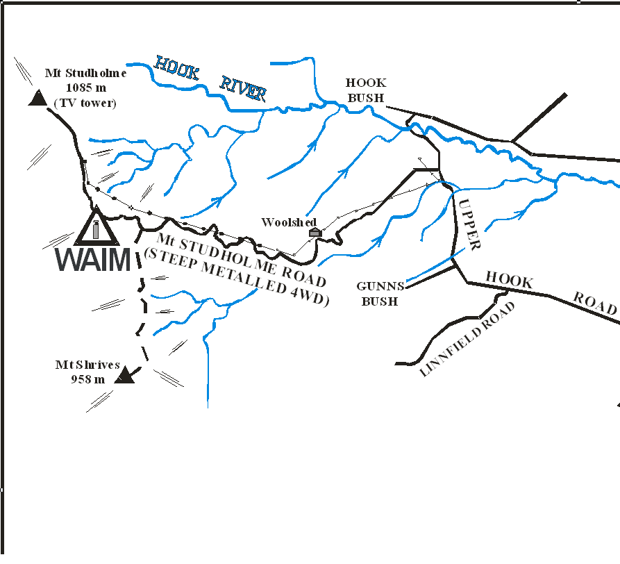
CGPS station WAIM is situated on top of the Hunters Hills about 13 km NW of Waimate. Access is from Mt Studholme Rd. From Waimate and at the intersection of SH 82 and Upper Parsonage Rd (0.00 km) follow Upper Parsonage Rd to the merge with Whitneys Rd (2.0 km) then turn N into Waimate-Hunter Rd (2.1 km) and follow to Deep Creek (4.2 km) where Waimate-Hunter Rd turns NW. Follow Waimate-Hunter Rd to Gunns Corner and the intersection with Upper Hook Rd (7.4 km). Follow Upper Hook Rd to the entrance/gate with Mt Studholme Rd (11.8 km). Turn W into Mt Studholme Rd and follow the steep metalled road to the ridge top (17.8 km). Take the left-hand track around a small knoll to the Telecom cell tower and other radio antennas (17.9km). The CGPS station is west of cell tower and on top of the small knoll. Mt Studholme road is steep and can be rutted and washed out a 4WD vehicle is recommended.
|
|
Access Date:
|
|
Cellphone coverage:
Telecom: Good, Vodafone: Good, 2degrees: Not tested
|
|
|
Access Diagram:
May not be to scale
|
|
|
|
Date Beacon Erected:
15-Dec-2004
|
|
Beacon Type:
Pillar
|
|
Beacon Measurement date:
* 08-Aug-2012
|
|
Beacon Eccentricity:
CENTRAL
|
|
|
Beacon Diagram:
|

|
|
*
The data in Landonline may be more recent