TAUP: Mark diagram 14-Nov-2006
(Superceded)
|
Mark and site detail
(Superceded)
|
Geodetic Code:
TAUP
|
|
Name:
Taupo Airport
|
Mark type:
Other
|
|
Land District:
South Auckland
|
Plan References:
|
|
Topo50 Reference:
BG36 678 073
|
NZTM:
5707266
1867780
|
|
|
Date established:
22-Mar-2002
|
Date of Inspection:
* 14-Nov-2006
|
|
Mark Description:
* Stainless steel bolt with 5/8 thead in centre of 100mm diameter stainless steel plate set central in top of 300mm diameter concrete pillar. Bronze ID plaque.
|
|
Mark Protection Structure Type:
* No protection.
|
|
GNSS Suitability:
|
|
Public ownership:
Unknown
|
|
|
|
|
Access Restrictions:
None
|
|
Access Notes:
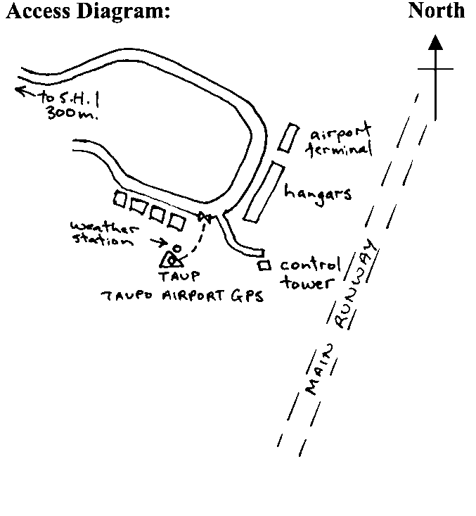
In grassed area of Taupo Airport 100 m m south of road and 150 m west of control tower. Access from road thru gate to trig.
|
|
Access Date:
|
|
Cellphone coverage:
|
|
|
Access Diagram:
May not be to scale
|
|
|
|
Date Beacon Erected:
|
|
Beacon Type:
Pillar
|
|
Beacon Measurement date:
* 14-Nov-2006
|
|
Beacon Eccentricity:
Central
|
|
|
Beacon Diagram:
|

|
|
*
The data in Landonline may be more recent