HAMT: Mark diagram 26-Nov-2006
(Superceded)
|
Mark and site detail
(Superceded)
|
Geodetic Code:
HAMT
|
|
Name:
Hamilton
|
Mark type:
* Other
|
|
Land District:
South Auckland
|
Plan References:
|
|
Topo50 Reference:
BD33 857 135
|
NZTM:
5813530
1785677
|
|
|
Date established:
13-May-2003
|
Date of Inspection:
* 26-Nov-2006
|
|
Mark Description:
* Stainless steel bolt with 5/8 thead in centre of 100mm diameter stainless steel plate set central in top of 300mm diameter concrete pillar. Bronze ID plaque.
|
|
Mark Protection Structure Type:
* Post & rail enclosure.
Aluminium ID plate
|
|
GNSS Suitability:
|
|
Public ownership:
Unknown
|
|
|
|
|
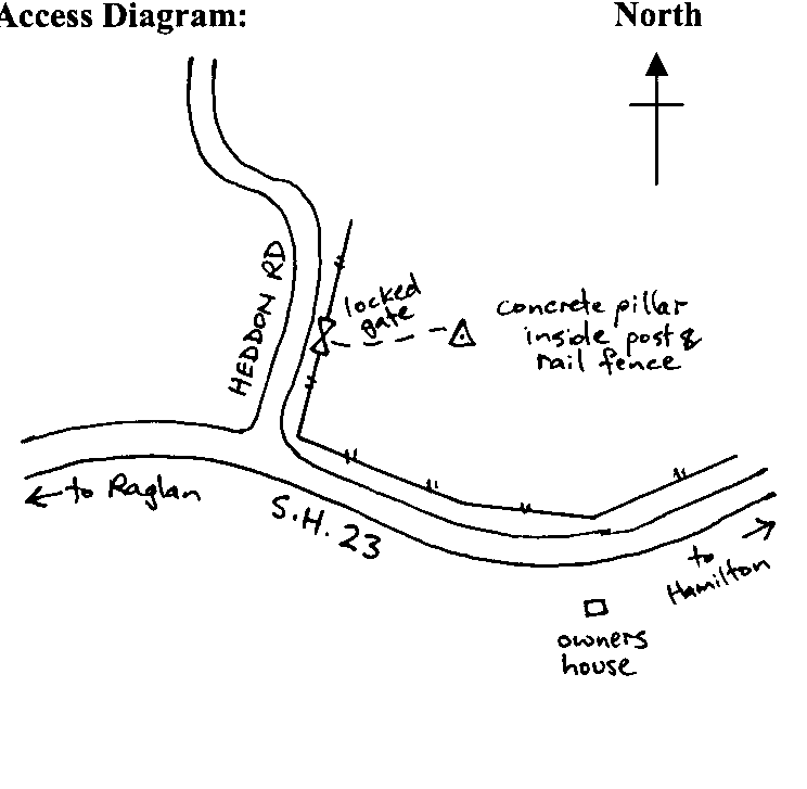
Access Restrictions:
Locked gate
|
|
Access Notes:
In paddock 200 m north of SH 23 and 150 m east of Heddon Rd. Access from Heddon Rd, thru locked gate and 4WD across paddock to trig.
|
|
Access Date:
|
|
Cellphone coverage:
|
|
|
Access Diagram:
May not be to scale
|
|
|
|
Date Beacon Erected:
|
|
Beacon Type:
Pillar
|
|
Beacon Measurement date:
* 26-Nov-2006
|
|
Beacon Eccentricity:
Central
|
|
|
Beacon Diagram:
|

|
|
*
The data in Landonline may be more recent