EXA4: Mark diagram 01-Dec-2016
|
Mark and site detail
|
Geodetic Code:
EXA4
|
|
Name:
PIN 1 SO 507637
|
Mark type:
Pin
|
|
Land District:
Nelson
|
Plan References:
SO 507637
|
|
Topo50 Reference:
BQ26 275 366
|
NZTM:
5436648
1627468
|
|
|
Date established:
01-Dec-2016
|
Date of Inspection:
01-Dec-2016
|
|
Mark Description:
* 22mm SS pin set in concrete block 0.14m below ground level. Bronze ID plaque.
|
|
Mark Protection Structure Type:
* Plastic Cover.
Plastic Marker Post.
|
|
GNSS Suitability:
|
|
Public ownership:
Unknown
|
|
|
|
|
Access Restrictions:
|
|
Access Notes:
NE side of State Hwy 6 at side of large gravel carpark approx. north of Allisdair Street. 120m south of driveway to house #38.
|
|
Access Date:
|
|
Cellphone coverage:
Spark: Good. Vodafone: Good. 2Degrees: Good
|
|
|
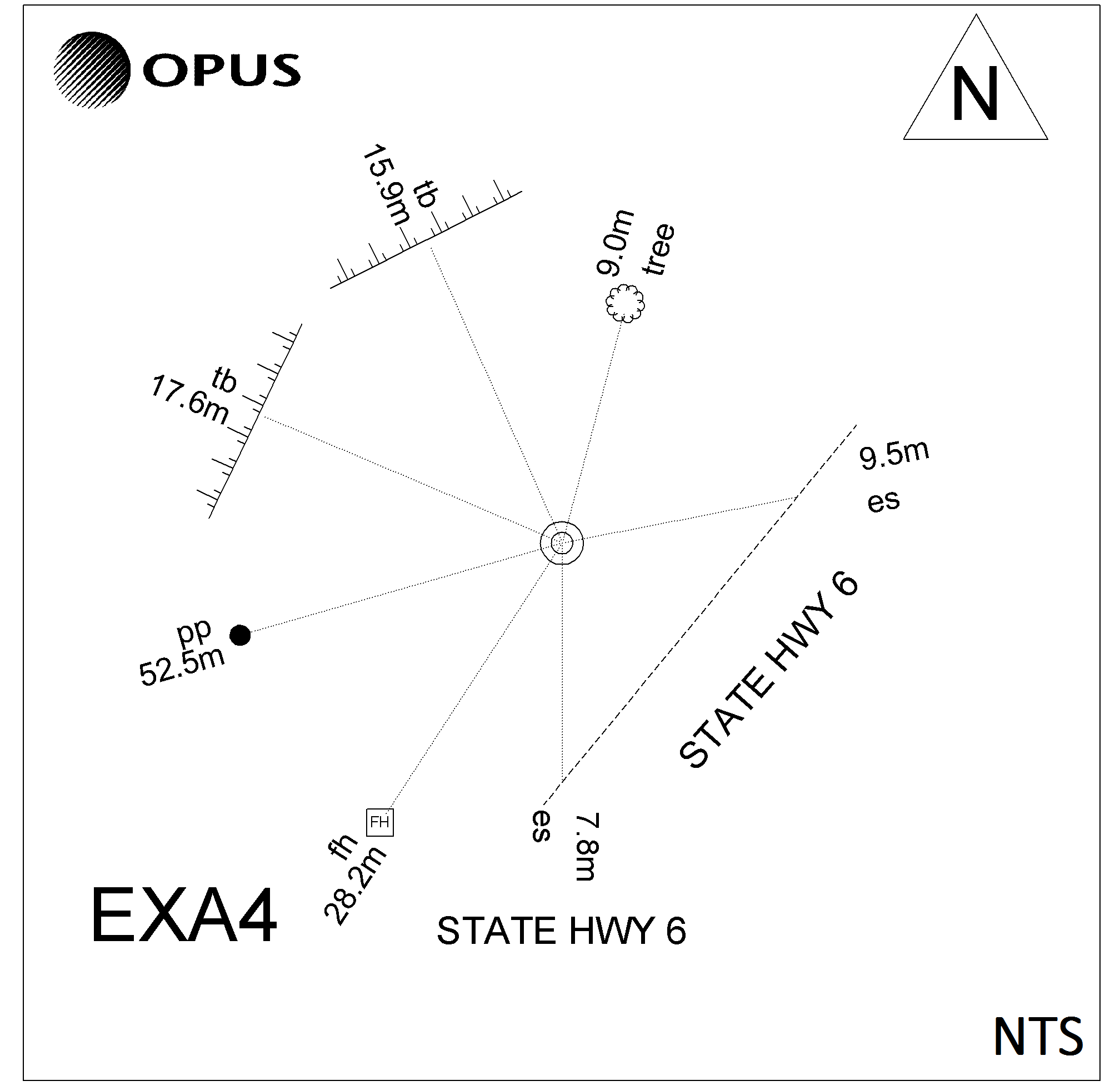
Access Diagram:
May not be to scale
|
|
|
|
Date Beacon Erected:
|
|
Beacon Type:
* Not Beaconed
|
|
Beacon Measurement date:
01-Dec-2016
|
|
Beacon Eccentricity:
|
|
|
Beacon Diagram:
|

|
|
*
The data in Landonline may be more recent