E4MC: Mark diagram 16-May-2006
(Superceded)
|
Mark and site detail
(Superceded)
|
Geodetic Code:
E4MC
|
|
Name:
GG TAMAIHU NO 3
|
Mark type:
Pin
|
|
Land District:
South Auckland
|
Plan References:
|
|
Topo50 Reference:
BA35 491 351
|
NZTM:
5935073
1849146
|
|
|
Date established:
|
Date of Inspection:
* 16-May-2006
|
|
Mark Description:
* Stainless steel pin set in concrete 20mm Bronze ID plaque.
|
|
Mark Protection Structure Type:
* 2m Beacon.
Aluminium ID plate
|
|
GNSS Suitability:
|
|
Public ownership:
Unknown
|
|
|
|
|
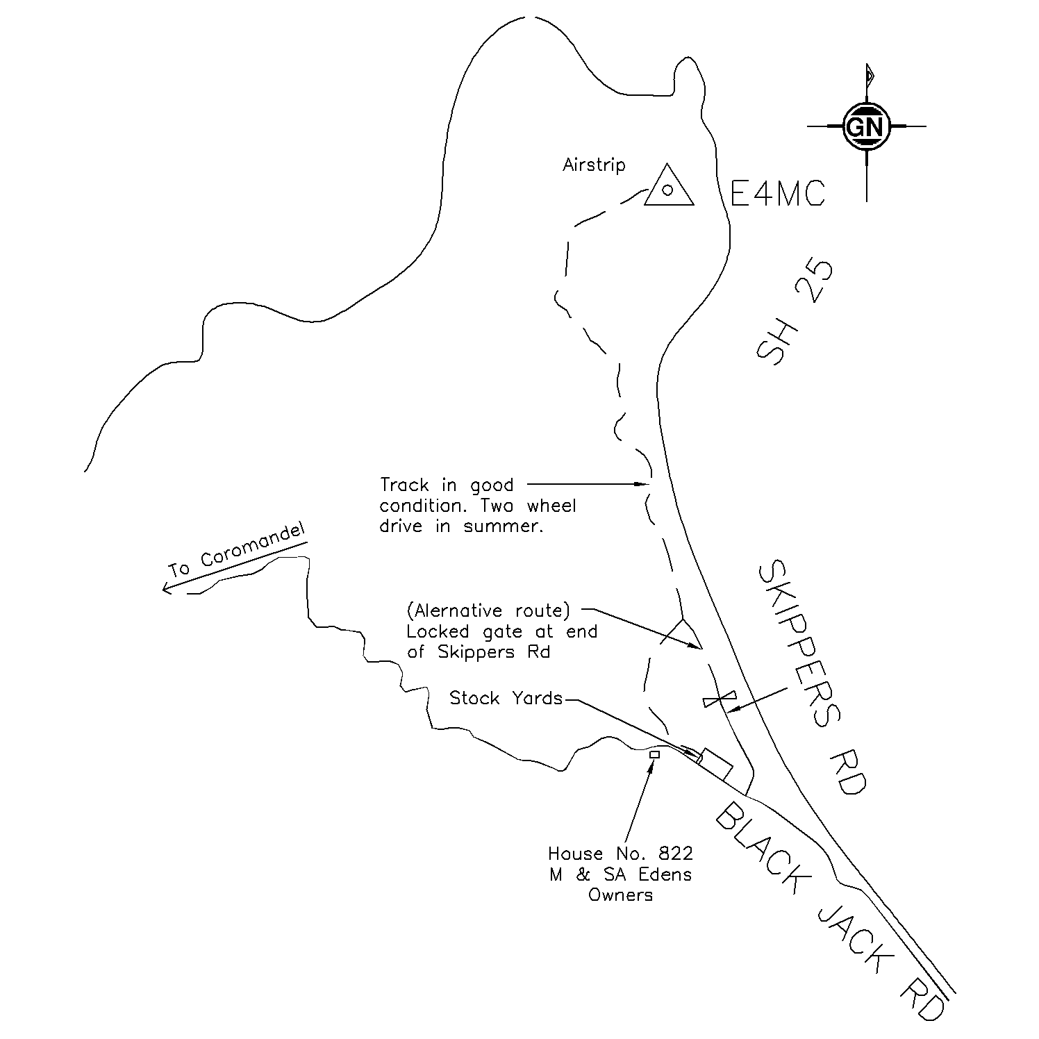
Access Restrictions:
Locked gate
|
|
Access Notes:
Head north on Black Jack Rd to Opito. At entrance to Opito drive through stockyards on LHS just past owners. Take farm track along side of beach then up the hill to the trig which is just past the airstrip. 4WD or 2WD when dry.
|
|
Access Date:
|
|
Cellphone coverage:
|
|
|
Access Diagram:
May not be to scale
|
|
|
|
Date Beacon Erected:
|
|
Beacon Type:
Two metre beacon
|
|
Beacon Measurement date:
* 16-May-2006
|
|
Beacon Eccentricity:
Central
|
|
|
Beacon Diagram:
|

|
|
*
The data in Landonline may be more recent