E4MC: Mark diagram 30-Apr-2014
|
Mark and site detail
|
Geodetic Code:
E4MC
|
|
Name:
GG TAMAIHU NO 3
|
Mark type:
Pin
|
|
Land District:
South Auckland
|
Plan References:
DP 315254
|
|
Topo50 Reference:
BA35 491 351
|
NZTM:
5935073
1849146
|
|
|
Date established:
|
Date of Inspection:
30-Apr-2014
|
|
Mark Description:
* Stainless steel pin set in concrete with 20mm bronze plaque. Lowered position of GG Tamaihu No 2 (A6XC); May 2006. Bronze ID plaque.
|
|
Mark Protection Structure Type:
* 2m Beacon.
Aluminium ID plate
|
|
GNSS Suitability:
|
|
Public ownership:
Unknown
|
|
|
|
|
Access Restrictions:
|
|
Access Notes:
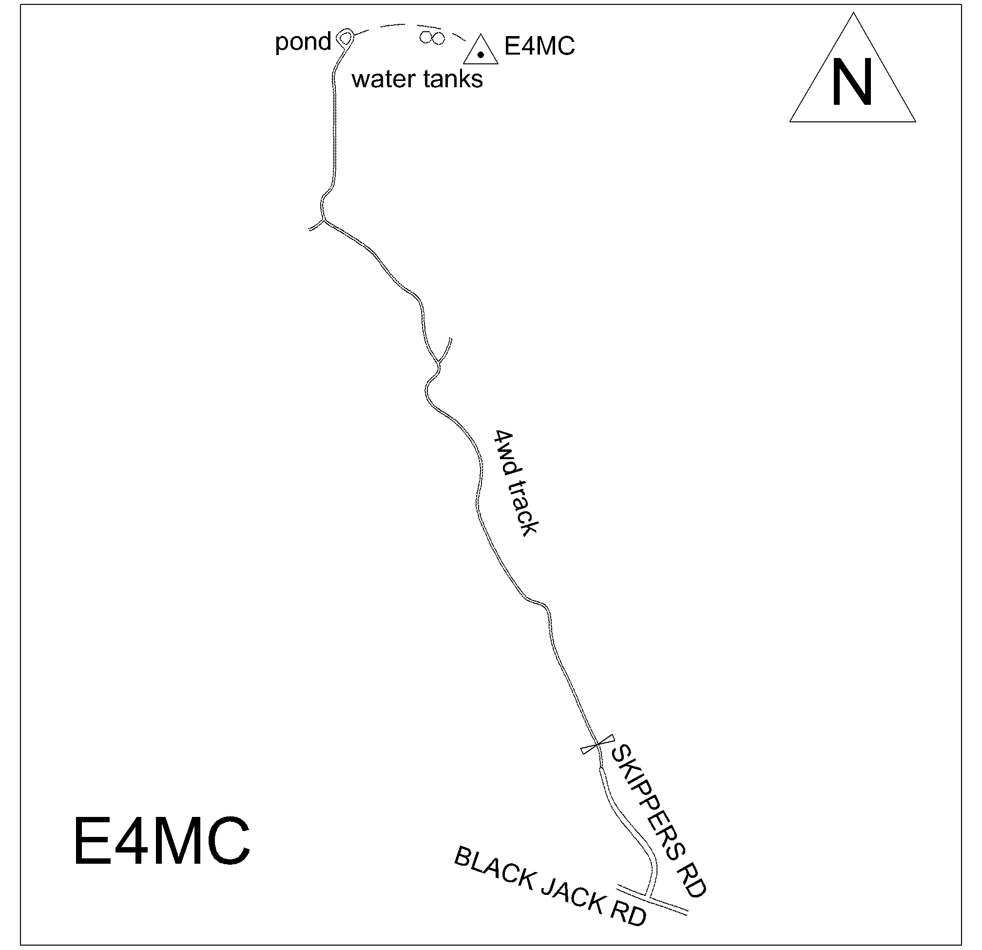
Head north on Black Jack Rd to Opito Bay. Turn left at Skippers Rd and go through gate at end (may be locked). Follow track until Y junction and take left arm up to main track to airstrip. Turn right to airstrip. At airstrip turn right and go around seaward side of tanks to trig.
|
|
Access Date:
|
|
Cellphone coverage:
Telecom: Not Tested. Vodafone: Good. 2Degrees: Not Tested
|
|
|
Access Diagram:
May not be to scale
|
|
|
|
Date Beacon Erected:
30-Apr-2014
|
|
Beacon Type:
Two metre beacon
|
|
Beacon Measurement date:
30-Apr-2014
|
|
Beacon Eccentricity:
Central
|
|
|
Beacon Diagram:
|

|
|
*
The data in Landonline may be more recent