DPL7: Mark diagram 06-Jan-2009
|
Mark and site detail
|
Geodetic Code:
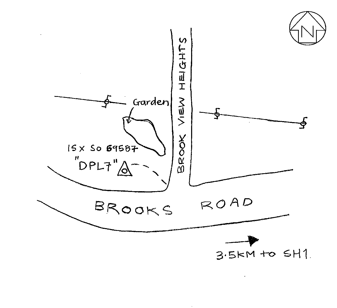
DPL7
|
|
Name:
IS X SO 69587
|
Mark type:
Pin
|
|
Land District:
North Auckland
|
Plan References:
SO 69587
|
|
Topo50 Reference:
AY30 257 121
|
NZTM:
6012138
1725691
|
|
|
Date established:
|
Date of Inspection:
06-Jan-2009
|
|
Mark Description:
* SS pin (25 mm dia) in concrete block Bronze ID plaque.
|
|
Mark Protection Structure Type:
* 2m Beacon.
Aluminium ID plate
|
|
GNSS Suitability:
|
|
Public ownership:
Unknown
|
|
|
|
|
Access Restrictions:
|
|
Access Notes:
From SH1 travel 3.5km west along Brooks Road to trig easily visible on north side of road just past Brook View Heights.
|
|
Access Date:
|
|
Cellphone coverage:
Available (027 Telecom)
|
|
|
Access Diagram:
May not be to scale
|
|
|
|
Date Beacon Erected:
06-Jan-2009
|
|
Beacon Type:
Two metre beacon
|
|
Beacon Measurement date:
06-Jan-2009
|
|
Beacon Eccentricity:
Central
|
|
|
Beacon Diagram:
|

|
|
*
The data in Landonline may be more recent