C31K: Mark diagram 06-Nov-2006
|
Mark and site detail
|
Geodetic Code:
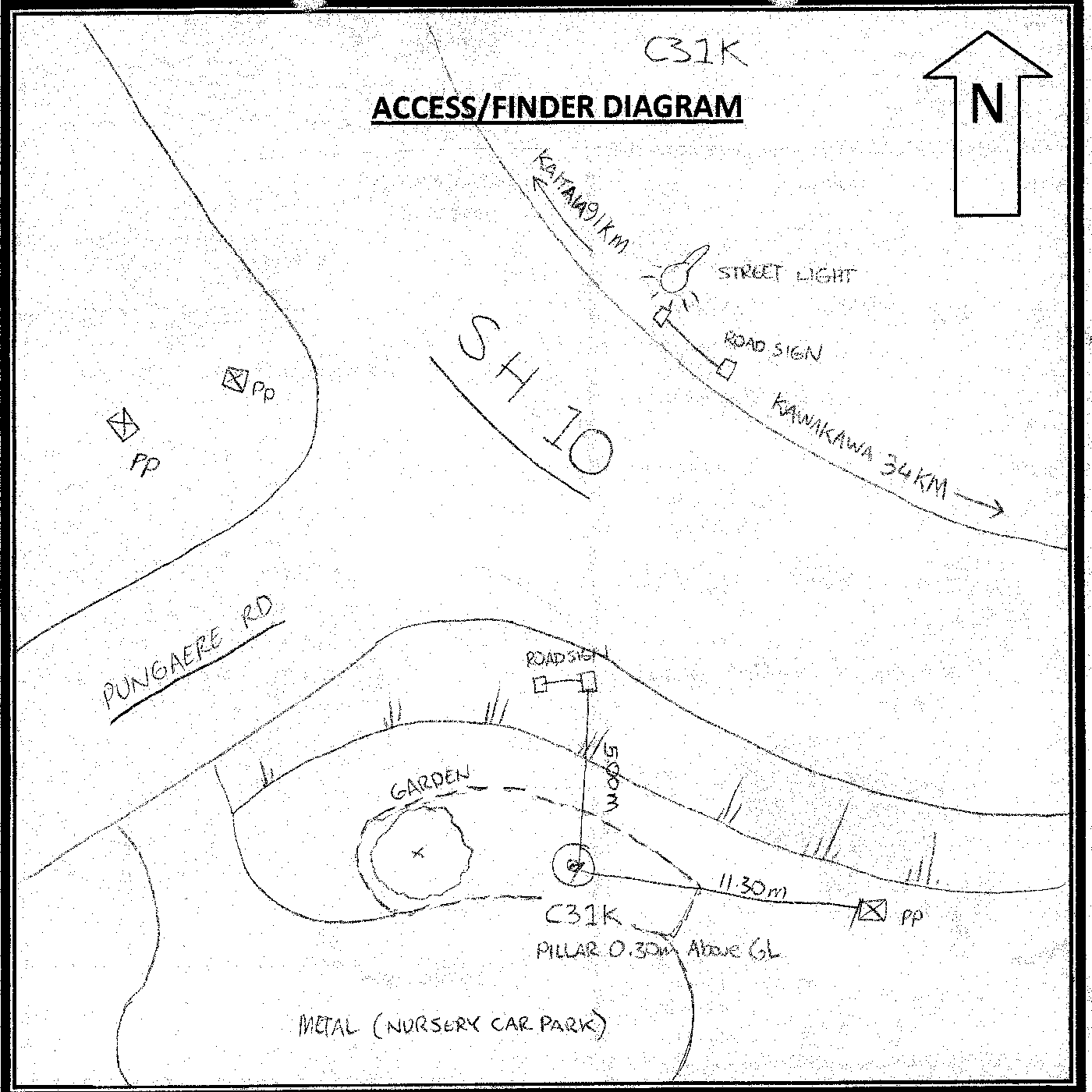
C31K
|
|
Name:
RM 1 SO 55463
|
Mark type:
* Pin
|
|
Land District:
North Auckland
|
Plan References:
SO 55463
|
|
Topo50 Reference:
AV28 831 041
|
NZTM:
6104124
1683074
|
|
|
Date established:
|
Date of Inspection:
* 06-Nov-2006
|
|
Mark Description:
* Brass plaque set in 0.2m round concrete block
|
|
Mark Protection Structure Type:
* No protection.
|
|
GNSS Suitability:
|
|
Public ownership:
Unknown
|
|
|
|
|
Access Restrictions:
|
|
Access Notes:
Located S of corner of SH10 and Pungaere Rd in garden 5.0m from road sign and 11.30m to PP
|
|
Access Date:
|
|
Cellphone coverage:
Good 021 Vodafone
|
|
|
Access Diagram:
May not be to scale
|
|
|
|
Date Beacon Erected:
|
|
Beacon Type:
Pillar
|
|
Beacon Measurement date:
* 06-Nov-2006
|
|
Beacon Eccentricity:
|
|
|
Beacon Diagram:
|

|
|
*
The data in Landonline may be more recent