BVBN: Mark diagram 23-Jan-2013
(Superceded)
|
Mark and site detail
(Superceded)
|
Geodetic Code:
BVBN
|
|
Name:
SM 3352 SO 55772
|
Mark type:
Plaque
|
|
Land District:
North Auckland
|
Plan References:
SO 55772
|
|
Topo50 Reference:
BB32 597 080
|
NZTM:
5907958
1759651
|
|
|
Date established:
|
Date of Inspection:
* 23-Jan-2013
|
|
Mark Description:
* L&S bronze plaque set in concrete block. Bronze ID plaque.
|
|
Mark Protection Structure Type:
* Cast Iron Cover.
No protection.
|
|
GNSS Suitability:
|
|
Public ownership:
Unknown
|
|
|
|
|
Access Restrictions:
No access restrictions
|
|
Access Notes:
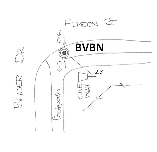
Mark is located in grass at SE corner of intersection of Bader Drive and Elmdon Street
|
|
Access Date:
|
|
Cellphone coverage:
Telecom: Good
|
|
|
Access Diagram:
May not be to scale
|
|
|
|
Date Beacon Erected:
|
|
Beacon Type:
Not Beaconed
|
|
Beacon Measurement date:
* 23-Jan-2013
|
|
Beacon Eccentricity:
|
|
|
Beacon Diagram:
|

|
|
*
The data in Landonline may be more recent