BUHH: Mark diagram 08-May-2006
(Superceded)
|
Mark and site detail
(Superceded)
|
Geodetic Code:
BUHH
|
|
Name:
RCM 15 SO 62667
|
Mark type:
Pin
|
|
Land District:
North Auckland
|
Plan References:
SO 62667
|
|
Topo50 Reference:
AV26 200 254
|
NZTM:
6125417
1619998
|
|
|
Date established:
01-Apr-1988
|
Date of Inspection:
08-May-2006
|
|
Mark Description:
* 12 mm stainless steel pin in 0.04 m dia iron pipe in concrete pillar 0.20 m dia and 0.52 m above ground level. No known buried mark Bronze ID plaque.
|
|
Mark Protection Structure Type:
* 2m Beacon.
Aluminium ID plate
|
|
GNSS Suitability:
|
|
Public ownership:
Unknown
|
|
|
|
|
Access Restrictions:
|
|
Access Notes:
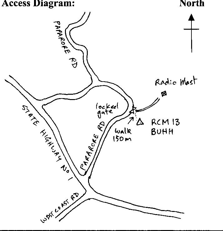
On top of low hill in paddock, 30 m east of fence and 200 m south of radio mast. Access from SH 1 turn right 100 m past West Coast Rd into Pararore Rd (old SH 1) and drive for 900 m to driveway going to radio mast. Climb fences and walk 150 m up paddock to trig.
|
|
Access Date:
|
|
Cellphone coverage:
|
|
|
Access Diagram:
May not be to scale
|
|
|
|
Date Beacon Erected:
03-Nov-1999
|
|
Beacon Type:
* Two metre beacon
|
|
Beacon Measurement date:
08-May-2006
|
|
Beacon Eccentricity:
Central
|
|
|
Beacon Diagram:
|

|
|
*
The data in Landonline may be more recent