BUHB: Mark diagram 18-Mar-2020
|
Mark and site detail
|
Geodetic Code:
BUHB
|
|
Name:
SM 1664 SO 66863
|
Mark type:
Pin
|
|
Land District:
North Auckland
|
Plan References:
SO 66863
|
|
Topo50 Reference:
AV26 289 133
|
NZTM:
6113349
1628940
|
|
|
Date established:
01-Jun-1993
|
Date of Inspection:
18-Mar-2020
|
|
Mark Description:
* Stainless Steel Pin Set In IT Set In Concrete Pillar. ID plaque and plate attached Bronze ID plaque.
|
|
Mark Protection Structure Type:
* 2m Beacon.
Aluminium ID plate
|
|
GNSS Suitability:
|
|
Public ownership:
Unknown
|
|
|
|
|
Access Restrictions:
Phone first
|
|
Access Notes:
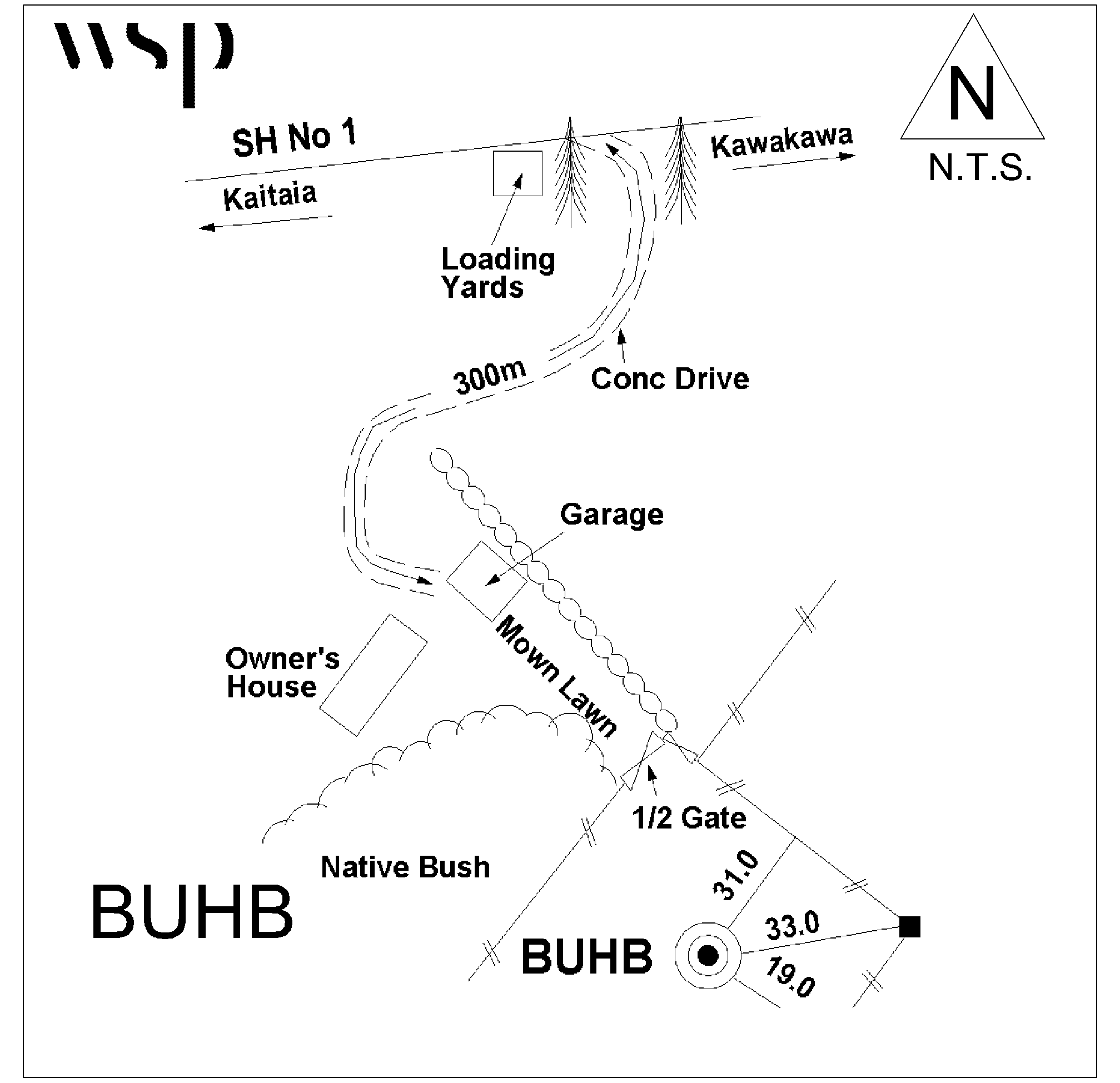
Mark is situated on rounded hill on the southern side of SH No 1 2.5km south of Fryers Road and 700m north of Ruaroa Road. Follow concrete drive up to owners house then walk south across mown lawn bet. On top of round hill above address number 7333 SH1
|
|
Access Date:
|
|
Cellphone coverage:
Spark: Good. Vodafone: Not tested. 2Degrees: Not tested
|
|
|
Access Diagram:
May not be to scale
|
|
|
|
Date Beacon Erected:
02-Nov-1999
|
|
Beacon Type:
Two metre metal beacon
|
|
Beacon Measurement date:
18-Mar-2020
|
|
Beacon Eccentricity:
Now Central
|
|
|
Beacon Diagram:
|

|
|
*
The data in Landonline may be more recent