BPUY: Mark diagram 07-Dec-2020
|
Mark and site detail
|
Geodetic Code:
BPUY
|
|
Name:
IT II DP 24064
|
Mark type:
Pin
|
|
Land District:
Canterbury
|
Plan References:
|
|
Topo50 Reference:
BX20 822 636
|
NZTM:
5163628
1482222
|
|
|
Date established:
|
Date of Inspection:
07-Dec-2020
|
|
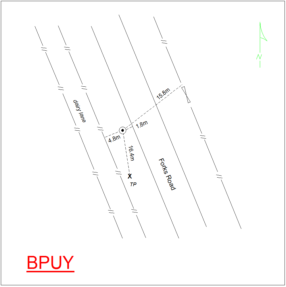
Mark Description:
* Stainless Steel Pin inside Iron Tube set in concrete pad. 0.2 down, In stable ground. ID plaque and plate attached. Mark is 1.8m to edge of seal and approx. 0.3m below the road. Bronze ID plaque.
|
|
Mark Protection Structure Type:
* Cast Iron Cover.
Marker Post.
Aluminium ID plate
|
|
GNSS Suitability:
|
|
Public ownership:
Unknown
|
|
|
|
|
Access Restrictions:
No Access Restrictions
|
|
Access Notes:
On western side of Forks Road, 0.7km south east of Rangitata Diversion Race, 3.8km north west of Ashburton Staveley Road intersection.
|
|
Access Date:
|
|
Cellphone coverage:
Spark: Good, Vodafone: Good, 2 Degrees: Good
|
|
|
Access Diagram:
May not be to scale
|
|
|
|
Date Beacon Erected:
|
|
Beacon Type:
Not Beaconed
|
|
Beacon Measurement date:
07-Dec-2020
|
|
Beacon Eccentricity:
|
|
|
Beacon Diagram:
|

|
|
*
The data in Landonline may be more recent