BGUT: Mark diagram 12-Mar-2017
(Superceded)
|
Mark and site detail
(Superceded)
|
Geodetic Code:
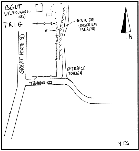
BGUT
|
|
Name:
W (Waipukurau SD)
|
Mark type:
Pin
|
|
Land District:
Hawkes Bay
|
Plan References:
SO 9300
|
|
Topo50 Reference:
BL38 075 731
|
NZTM:
5573095
1907466
|
|
|
Date established:
01-Feb-1932
|
Date of Inspection:
* 12-Mar-2017
|
|
Mark Description:
* SS pin set in an iron tube in a concrete block Bronze ID plaque.
|
|
Mark Protection Structure Type:
* 2m Beacon.
Aluminium ID plate
|
|
GNSS Suitability:
|
|
Public ownership:
Unknown
|
|
|
|
|
Access Restrictions:
Private land
|
|
Access Notes:
Access is via 16A Tamumu rds. travel along driveway, mark is visible to the west on top of the hill. Waipawa
|
|
Access Date:
|
|
Cellphone coverage:
Spark: Good
|
|
|
Access Diagram:
May not be to scale
|
|
|
|
Date Beacon Erected:
|
|
Beacon Type:
Two metre metal beacon
|
|
Beacon Measurement date:
* 12-Mar-2017
|
|
Beacon Eccentricity:
Central
|
|
|
Beacon Diagram:
|

|
|
*
The data in Landonline may be more recent