BDYG: Mark diagram 30-Jul-2014
|
Mark and site detail
|
Geodetic Code:
BDYG
|
|
Name:
SS 1125 SO 19592
|
Mark type:
Pin
|
|
Land District:
Canterbury
|
Plan References:
SO 19592
|
|
Topo50 Reference:
BX24 726 759
|
NZTM:
5175945
1572577
|
|
|
Date established:
01-Jul-1989
|
Date of Inspection:
* 30-Jul-2014
|
|
Mark Description:
* Circular bronze plaque set in concrete. Became disturbed due to 2010 and 2011 Canterbury earthquake sequence. See final position ETAV. Bronze ID plaque.
|
|
Mark Protection Structure Type:
* No protection.
|
|
GNSS Suitability:
|
|
Public ownership:
Unknown
|
|
|
|
|
Access Restrictions:
|
|
Access Notes:
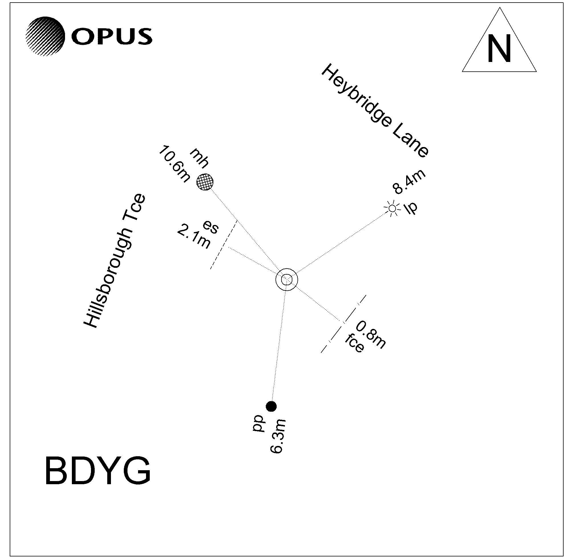
Mark located in grass berm at the intersection of Hillsborough Terrace and Heybridge Lane
|
|
Access Date:
|
|
Cellphone coverage:
Telecom: Good. Vodafone: Good. 2Degrees: Good
|
|
|
Access Diagram:
May not be to scale
|
|
|
|
Date Beacon Erected:
|
|
Beacon Type:
Not Beaconed
|
|
Beacon Measurement date:
* 30-Jul-2014
|
|
Beacon Eccentricity:
|
|
|
Beacon Diagram:
|

|
|
*
The data in Landonline may be more recent