BDYG: Mark diagram 20-Oct-2010
(Superceded)
|
Mark and site detail
(Superceded)
|
Geodetic Code:
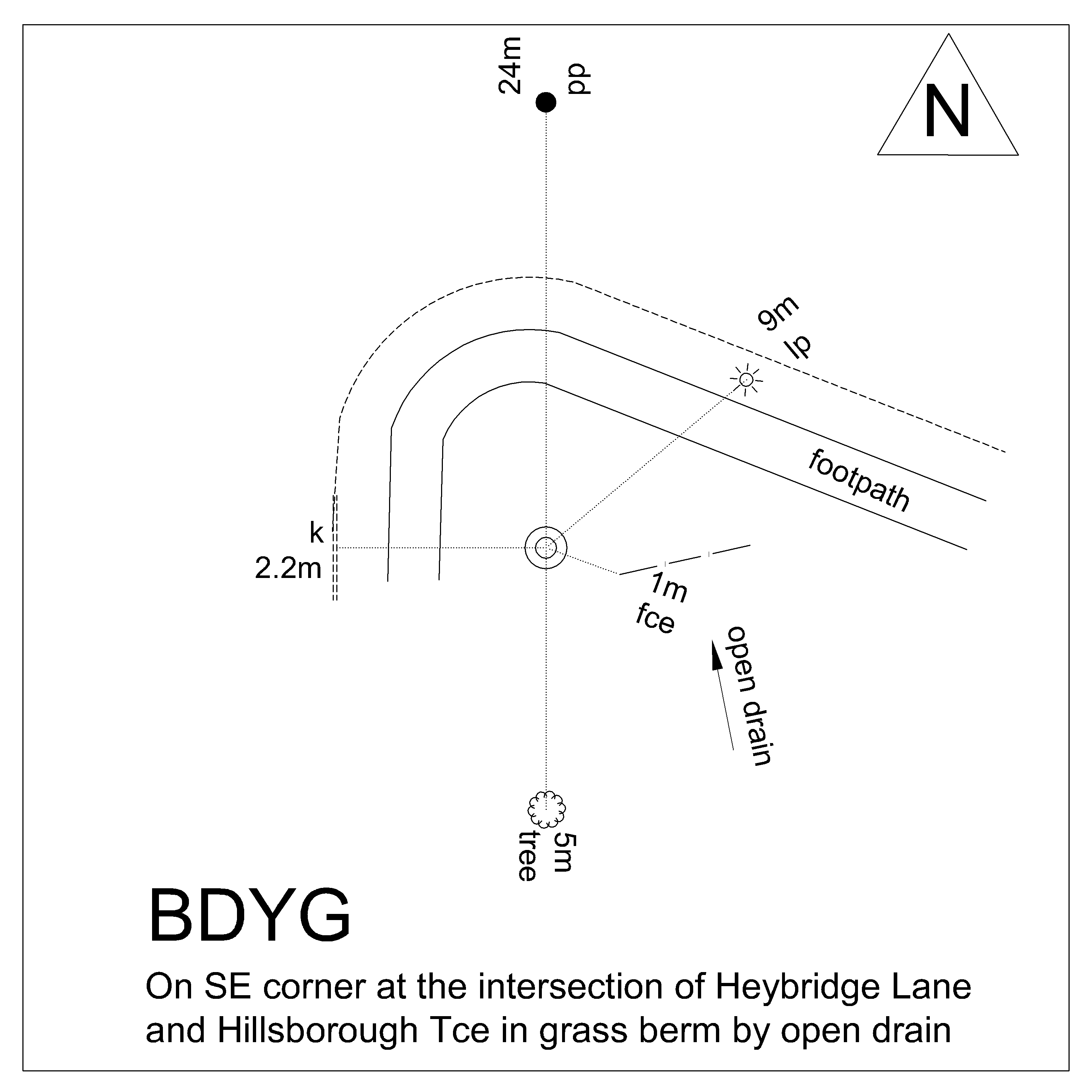
BDYG
|
|
Name:
SS 1125 SO 19592
|
Mark type:
Pin
|
|
Land District:
Canterbury
|
Plan References:
SO 19592
|
|
Topo50 Reference:
BX24 726 759
|
NZTM:
5175945
1572577
|
|
|
Date established:
01-Aug-1989
|
Date of Inspection:
* 20-Oct-2010
|
|
Mark Description:
* SS pin set in conc. Flush. Bronze ID plaque.
|
|
Mark Protection Structure Type:
* No protection.
|
|
GNSS Suitability:
|
|
Public ownership:
Unknown
|
|
|
|
|
Access Restrictions:
|
|
Access Notes:
Located in grass berm behind footpath at southeast corner of intersection of Hillsborough Tce and Heybridge Lane.
|
|
Access Date:
|
|
Cellphone coverage:
027 good
|
|
|
Access Diagram:
May not be to scale
|
|
|
|
Date Beacon Erected:
|
|
Beacon Type:
Not Beaconed
|
|
Beacon Measurement date:
* 20-Oct-2010
|
|
Beacon Eccentricity:
|
|
|
Beacon Diagram:
|

|
|
*
The data in Landonline may be more recent