BDMF: Mark diagram 10-Jan-2006
(Superceded)
|
Mark and site detail
(Superceded)
|
Geodetic Code:
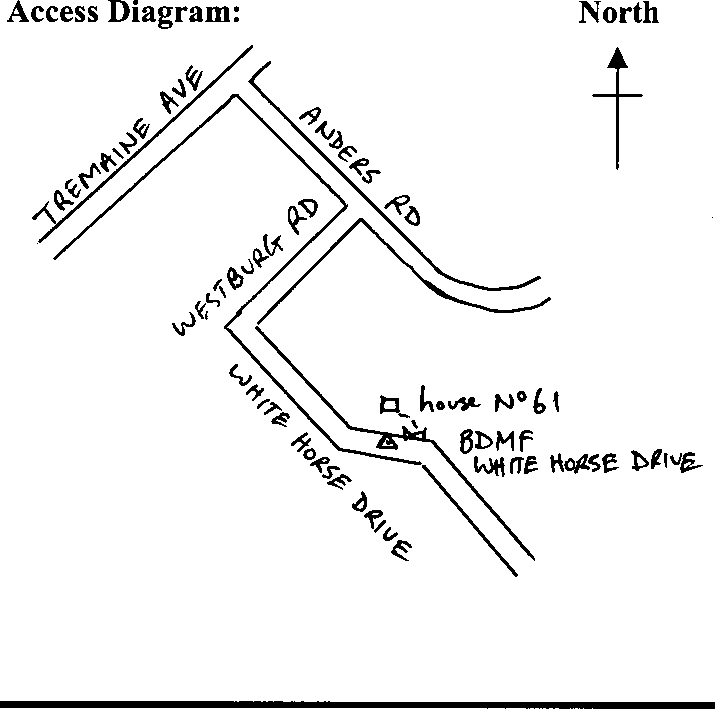
BDMF
|
|
Name:
WHITE HORSE DRIVE
|
Mark type:
Pin
|
|
Land District:
Wellington
|
Plan References:
|
|
Topo50 Reference:
BM34 178 282
|
NZTM:
5528188
1817779
|
|
|
Date established:
01-Mar-1998
|
Date of Inspection:
* 10-Jan-2006
|
|
Mark Description:
* 25 mm stainless steel pin in concrete block 0.35 x0.35 m 0.17 m below ground level under iron cover Bronze ID plaque.
|
|
Mark Protection Structure Type:
* Cast Iron Cover.
|
|
GNSS Suitability:
|
|
Public ownership:
Unknown
|
|
|
|
|
Access Restrictions:
|
|
Access Notes:
In edge of sealed road outside No 61 White Horse Drive. 7 m from fence and 18 m from entrance to No 61. Access from Tremaine Ave, into Anders Rd and turn right into Westburg St and left into White Horse Dr.
|
|
Access Date:
|
|
Cellphone coverage:
|
|
|
Access Diagram:
May not be to scale
|
|
|
|
Date Beacon Erected:
|
|
Beacon Type:
Not Beaconed
|
|
Beacon Measurement date:
* 10-Jan-2006
|
|
Beacon Eccentricity:
|
|
|
Beacon Diagram:
|

|
|
*
The data in Landonline may be more recent