BDMF: Mark diagram 15-Feb-2018
|
Mark and site detail
|
Geodetic Code:
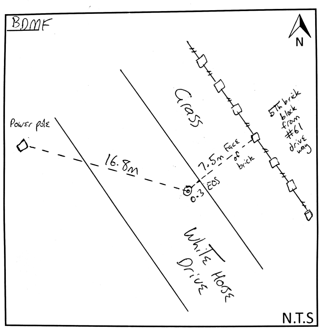
BDMF
|
|
Name:
WHITE HORSE DRIVE
|
Mark type:
Pin
|
|
Land District:
Wellington
|
Plan References:
SO 372147
|
|
Topo50 Reference:
BM34 178 282
|
NZTM:
5528188
1817779
|
|
|
Date established:
01-Mar-1998
|
Date of Inspection:
15-Feb-2018
|
|
Mark Description:
* This mark is used for deformation monitoring, do not alter the ground mark in any way. Steel pin under cast iron cover in seal, outside number 61 White Horse Drive. Bronze ID plaque.
|
|
Mark Protection Structure Type:
* Cast Iron Cover.
|
|
GNSS Suitability:
|
|
Public ownership:
Unknown
|
|
|
|
|
Access Restrictions:
No access restrictions
|
|
Access Notes:
In edge of sealed road outside No 61 White Horse Drive. 7 m from fence and 18 m from entrance to No 61. Access from Tremaine Ave, into Anders Rd and turn right into Westburg St and left into White Horse Dr.
|
|
Access Date:
|
|
Cellphone coverage:
Spark: Good, Vodafone: Not Tested, 2Degrees: Not Tested
|
|
|
Access Diagram:
May not be to scale
|
|
|
|
Date Beacon Erected:
|
|
Beacon Type:
Not Beaconed
|
|
Beacon Measurement date:
15-Feb-2018
|
|
Beacon Eccentricity:
|
|
|
Beacon Diagram:
|

|
|
*
The data in Landonline may be more recent