BDBX: Mark diagram 08-Jun-2020
(Superceded)
|
Mark and site detail
(Superceded)
|
Geodetic Code:
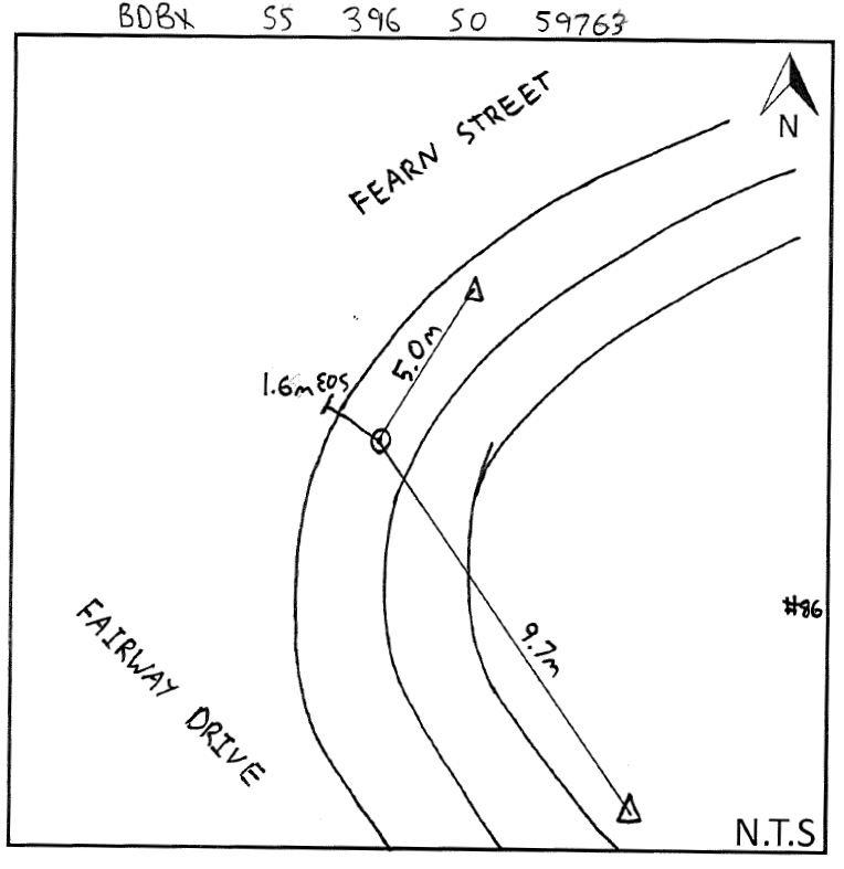
BDBX
|
|
Name:
SS 396 SO 59763
|
Mark type:
Plaque
|
|
Land District:
North Auckland
|
Plan References:
SO 59763
|
|
Topo50 Reference:
AX30 178 495
|
NZTM:
6049497
1717784
|
|
|
Date established:
01-Jun-1980
|
Date of Inspection:
* 08-Jun-2020
|
|
Mark Description:
* This mark is used for deformation monitoring, do not alter the ground mark in any way. Brass plaque set in concrete. ID plaque attached. Bronze ID plaque.
|
|
Mark Protection Structure Type:
* Cast Iron Cover.
No protection.
|
|
GNSS Suitability:
|
|
Public ownership:
Unknown
|
|
|
|
|
Access Restrictions:
No access restrictions
|
|
Access Notes:
In grass berm on corner of Fairway Drive and Fearn Street.
|
|
Access Date:
|
|
Cellphone coverage:
Telecom: Good. Vodafone: Good. 2Degrees: Not Tested
|
|
|
Access Diagram:
May not be to scale
|
|
|
|
Date Beacon Erected:
|
|
Beacon Type:
Not Beaconed
|
|
Beacon Measurement date:
* 08-Jun-2020
|
|
Beacon Eccentricity:
|
|
|
Beacon Diagram:
|

|
|
*
The data in Landonline may be more recent