BCVQ: Mark diagram 12-Feb-2013
|
Mark and site detail
|
Geodetic Code:
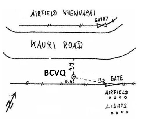
BCVQ
|
|
Name:
SM 145 SO 49227
|
Mark type:
Plaque
|
|
Land District:
North Auckland
|
Plan References:
SO 49227
|
|
Topo50 Reference:
BA31 466 276
|
NZTM:
5927600
1746591
|
|
|
Date established:
|
Date of Inspection:
12-Feb-2013
|
|
Mark Description:
* Bronze pin set in concrete block. Bronze ID plaque.
|
|
Mark Protection Structure Type:
* Cast Iron Cover.
Marker Post.
Aluminium ID plate
|
|
GNSS Suitability:
|
|
Public ownership:
Unknown
|
|
|
|
|
Access Restrictions:
No access restrictions
|
|
Access Notes:
Mark is located beside fence on west side of Kauri Rd, opposite Whenuapai Air Base and near runway lights and gate 7.
|
|
Access Date:
|
|
Cellphone coverage:
Telecom: Good
|
|
|
Access Diagram:
May not be to scale
|
|
|
|
Date Beacon Erected:
|
|
Beacon Type:
Not Beaconed
|
|
Beacon Measurement date:
12-Feb-2013
|
|
Beacon Eccentricity:
|
|
|
Beacon Diagram:
|

|
|
*
The data in Landonline may be more recent