BCQN: Mark diagram 05-Dec-2010
|
Mark and site detail
|
Geodetic Code:
BCQN
|
|
Name:
SM 1097 SO 61207
|
Mark type:
Pin
|
|
Land District:
North Auckland
|
Plan References:
|
|
Topo50 Reference:
AX30 146 508
|
NZTM:
6050829
1714645
|
|
|
Date established:
|
Date of Inspection:
05-Dec-2010
|
|
Mark Description:
* Bronze plaque (LINZ) in concrete block 0.28 x 0.28 m- 0.05 m above ground level. Original trig pipe is below mark. Bronze ID plaque.
|
|
Mark Protection Structure Type:
* 2m Beacon.
Aluminium ID plate
|
|
GNSS Suitability:
|
|
Public ownership:
Unknown
|
|
|
|
|
Access Restrictions:
|
|
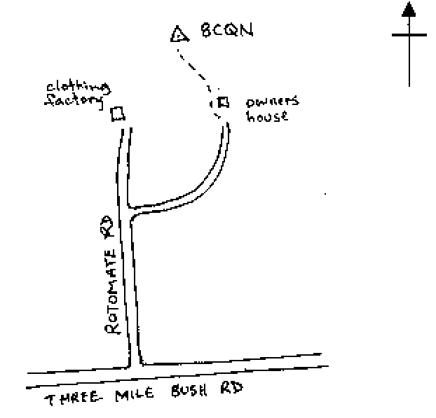
Access Notes:
On top of low hill 18 m east of fence and 44 m west of concrete water tank. Access from owners house and follow track west to trig. 4WD
|
|
Access Date:
|
|
Cellphone coverage:
027 OK
|
|
|
Access Diagram:
May not be to scale
|
|
|
|
Date Beacon Erected:
01-Mar-1998
|
|
Beacon Type:
Two metre beacon
|
|
Beacon Measurement date:
05-Dec-2010
|
|
Beacon Eccentricity:
CENTRAL
|
|
|
Beacon Diagram:
|

|
|
*
The data in Landonline may be more recent