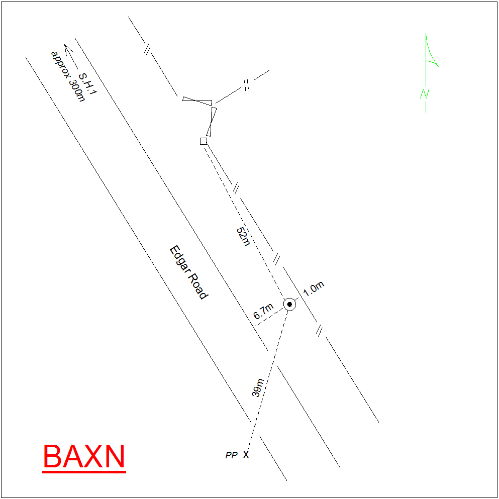
BAXN: Mark diagram 09-Dec-2020
|
Mark and site detail
|
Geodetic Code:
BAXN
|
|
Name:
BLK 44 SO 17029
|
Mark type:
Plaque
|
|
Land District:
Canterbury
|
Plan References:
|
|
Topo50 Reference:
BY20 700 193
|
NZTM:
5119329
1469969
|
|
|
Date established:
|
Date of Inspection:
09-Dec-2020
|
|
Mark Description:
* Bronze plaque in concrete block, down 0.30m with steel cap (flush) in concrete protection pad placed over block. ID plaque attached to block (18 Dec 1997). Geodetic Code previously allocated to Blk 22 (SO 17042). See GEO0204-10 of 21 Nov 1997. Mark is 6.7m to edge of seal and approx. 0.1m below the road. Bronze ID plaque.
|
|
Mark Protection Structure Type:
* Cast Iron Cover.
Marker Post.
Aluminium ID plate
|
|
GNSS Suitability:
|
|
Public ownership:
Unknown
|
|
|
|
|
Access Restrictions:
No Access Restrictions
|
|
Access Notes:
On northeast side of Edgar Road approx 300m south of SH1.
|
|
Access Date:
|
|
Cellphone coverage:
Spark: Good, Vodafone: Good, 2Degrees: Good
|
|
|
Access Diagram:
May not be to scale
|
|
|
|
Date Beacon Erected:
|
|
Beacon Type:
Not Beaconed
|
|
Beacon Measurement date:
09-Dec-2020
|
|
Beacon Eccentricity:
|
|
|
Beacon Diagram:
|

|
|
*
The data in Landonline may be more recent