BARX: Mark diagram 10-Apr-2021
|
Mark and site detail
|
Geodetic Code:
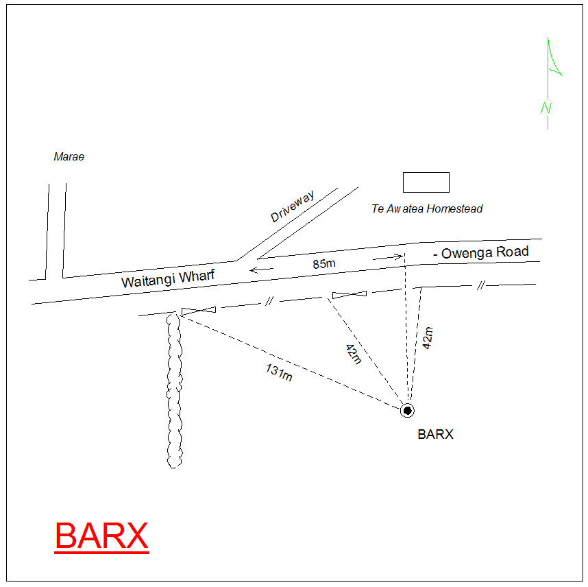
BARX
|
|
Name:
B KAPANGATAKAHU
|
Mark type:
Pin
|
|
Land District:
Wellington
|
Plan References:
SO 12263
|
|
Topo50 Reference:
|
NZTM:
5077543
2441372
|
|
|
Date established:
31-Dec-1868
|
Date of Inspection:
10-Apr-2021
|
|
Mark Description:
* 12mm stainless steel pin concreted in 5cm dia stainless steel pipe set in concrete collar ~0.16m above ground level. Bottle as buried mark.
|
|
Mark Protection Structure Type:
* No protection.
|
|
GNSS Suitability:
|
|
Public ownership:
Unknown
|
|
|
|
|
Access Restrictions:
Contact landowner prior to entry.
|
|
Access Notes:
85m east of driveway to Te Awatea homestead. Through gate on south side of road, 40m from gate to high point on ridge.
|
|
Access Date:
|
|
Cellphone coverage:
Spark: No Coverage. Vodafone: No Coverage. 2Degrees: No Coverage
|
|
|
Access Diagram:
May not be to scale
|
|
|
|
Date Beacon Erected:
|
|
Beacon Type:
Pillar
|
|
Beacon Measurement date:
10-Apr-2021
|
|
Beacon Eccentricity:
|
|
|
Beacon Diagram:
|

|
|
*
The data in Landonline may be more recent