BAC5: Mark diagram 30-Mar-2008
|
Mark and site detail
|
Geodetic Code:
BAC5
|
|
Name:
PAHOU
|
Mark type:
* Pin
|
|
Land District:
South Auckland
|
Plan References:
|
|
Topo50 Reference:
BE40 507 883
|
NZTM:
5788301
1950741
|
|
|
Date established:
01-Jan-1993
|
Date of Inspection:
* 30-Mar-2008
|
|
Mark Description:
* Concrete nail in 0.05 m dia galvanized iron pipe with concrete collar 0.11 m above ground level. Bronze ID plaque.
|
|
Mark Protection Structure Type:
* 2m Beacon.
Aluminium ID plate
|
|
GNSS Suitability:
|
|
Public ownership:
Unknown
|
|
|
|
|
Access Restrictions:
|
|
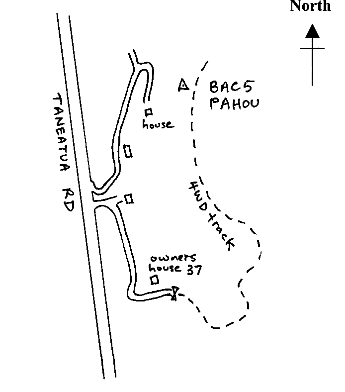
Access Notes:
On knob on west side of ridge 3 m from edge and 30 m west of vehicle track. Access from Taneatua Rd up 500 m driveway that runs south up to owners house. Continue past thru gate and follow 4WD track for 1.35 km to where trig can be seen on left. Walk 30 m.
|
|
Access Date:
|
|
Cellphone coverage:
027 Telecom, 021 Vodafone
|
|
|
Access Diagram:
May not be to scale
|
|
|
|
Date Beacon Erected:
01-Jan-1993
|
|
Beacon Type:
Two metre beacon
|
|
Beacon Measurement date:
* 30-Mar-2008
|
|
Beacon Eccentricity:
Central
|
|
|
Beacon Diagram:
|

|
|
*
The data in Landonline may be more recent