B9RT: Mark diagram 04-Apr-2017
|
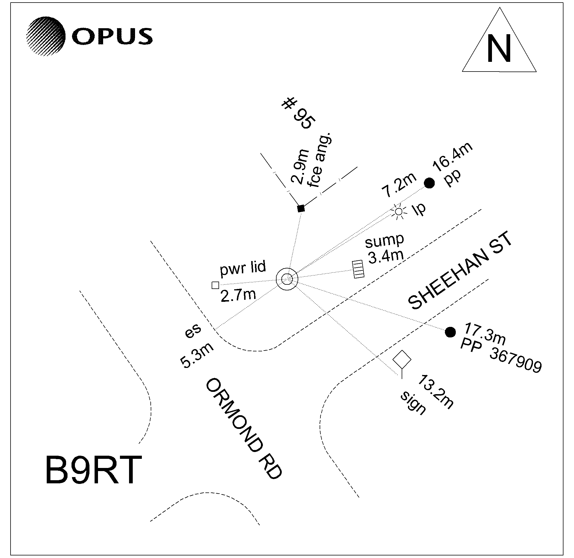
Mark and site detail
|
Geodetic Code:
B9RT
|
|
Name:
SS 167 SO 8025
|
Mark type:
Pin
|
|
Land District:
Gisborne
|
Plan References:
SO 8025
|
|
Topo50 Reference:
BG43 376 092
|
NZTM:
5709172
2037611
|
|
|
Date established:
05-May-1924
|
Date of Inspection:
04-Apr-2017
|
|
Mark Description:
* Brass pin set in concrete 0.1m beneath cast iron cover. Bronze ID plaque.
|
|
Mark Protection Structure Type:
* Cast Iron Cover.
|
|
GNSS Suitability:
|
|
Public ownership:
Unknown
|
|
|
|
|
Access Restrictions:
|
|
Access Notes:
In footpath on northern corner of Ormond Road & Sheehan Street intersection outside #95.
|
|
Access Date:
|
|
Cellphone coverage:
Spark: Good. Vodafone: Not Tested. 2Degrees: Not Tested
|
|
|
Access Diagram:
May not be to scale
|
|
|
|
Date Beacon Erected:
|
|
Beacon Type:
Not Beaconed
|
|
Beacon Measurement date:
04-Apr-2017
|
|
Beacon Eccentricity:
|
|
|
Beacon Diagram:
|

|
|
*
The data in Landonline may be more recent