B40V: Mark diagram 23-Sep-2011
(Superceded)
|
Mark and site detail
(Superceded)
|
Geodetic Code:
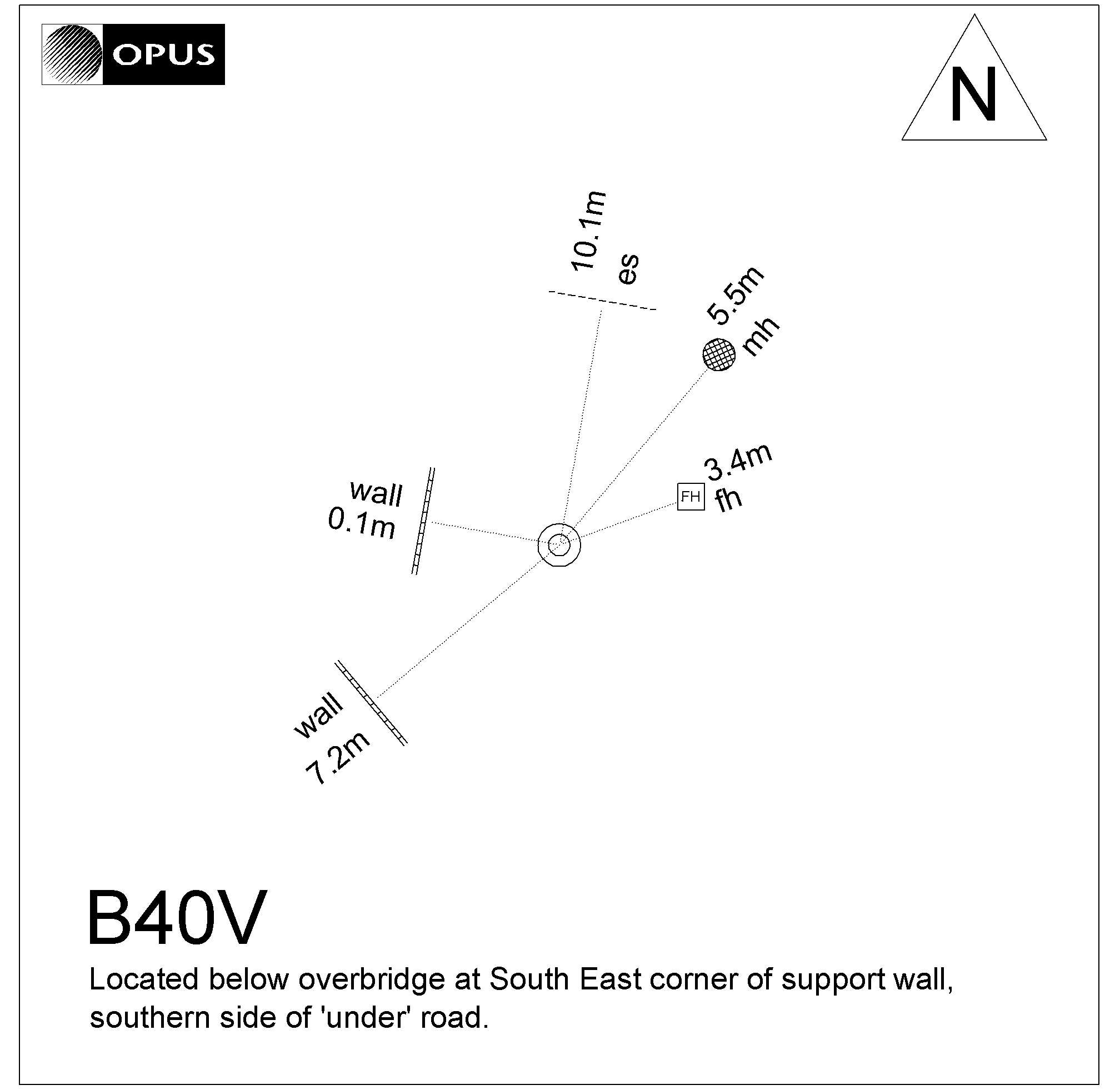
B40V
|
|
Name:
UD 40
|
Mark type:
Pin
|
|
Land District:
Canterbury
|
Plan References:
|
|
Topo50 Reference:
BX24 776 720
|
NZTM:
5171970
1577567
|
|
|
Date established:
01-Jan-1969
|
Date of Inspection:
* 23-Sep-2011
|
|
Mark Description:
* Stainless steel pin set in concrete.
|
|
Mark Protection Structure Type:
* No protection.
|
|
GNSS Suitability:
|
|
Public ownership:
Unknown
|
|
|
|
|
Access Restrictions:
Security clearance required
|
|
Access Notes:
Located below ferry overbridge at south east corner of support wall, southern side of 'under' road.
|
|
Access Date:
|
|
Cellphone coverage:
Telecom: Good. Vodafone: Not Tested. 2Degrees: Good
|
|
|
Access Diagram:
May not be to scale
|
|
|
|
Date Beacon Erected:
|
|
Beacon Type:
Not Beaconed
|
|
Beacon Measurement date:
* 23-Sep-2011
|
|
Beacon Eccentricity:
|
|
|
Beacon Diagram:
|

|
|
*
The data in Landonline may be more recent