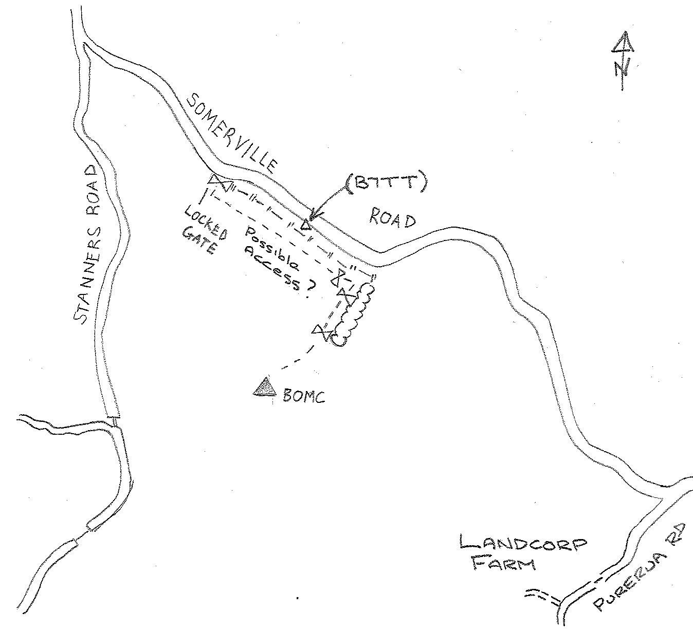
B0MC: Mark diagram 27-Jun-2007
(Superceded)
|
Mark and site detail
(Superceded)
|
Geodetic Code:
B0MC
|
|
Name:
1151 SO 58553
|
Mark type:
* Tube
|
|
Land District:
North Auckland
|
Plan References:
|
|
Topo50 Reference:
AV29 848 082
|
NZTM:
6108156
1684777
|
|
|
Date established:
|
Date of Inspection:
* 27-Jun-2007
|
|
Mark Description:
* 2 inch diameter galvanised iron tube, bottle as buried mark.
|
|
Mark Protection Structure Type:
* 3m or 4m Beacon.
|
|
GNSS Suitability:
|
|
Public ownership:
Unknown
|
|
|
|
|
Access Restrictions:
Contact Landcorp Farm Manager
|
|
Access Notes:
Access to the station was severely restricted when land was used for quarantine. 1151 No 2 established. See 6375-02-D01 of 18/12/89. Physical access by vehicle may still be difficult. Probably best to go to main farm entrance in Purerua Road
|
|
Access Date:
|
|
Cellphone coverage:
Available (021 Vodafone)
|
|
|
Access Diagram:
May not be to scale
|
|
|
|
Date Beacon Erected:
01-Jan-1978
|
|
Beacon Type:
* Four metre beacon
|
|
Beacon Measurement date:
* 27-Jun-2007
|
|
Beacon Eccentricity:
Central
|
|
|
Beacon Diagram:
|

|
|
*
The data in Landonline may be more recent