B0MC: Mark diagram 08-Sep-2010
|
Mark and site detail
|
Geodetic Code:
B0MC
|
|
Name:
1151 SO 58553
|
Mark type:
Pin
|
|
Land District:
North Auckland
|
Plan References:
SO 58553
|
|
Topo50 Reference:
AV29 848 082
|
NZTM:
6108156
1684777
|
|
|
Date established:
|
Date of Inspection:
* 08-Sep-2010
|
|
Mark Description:
* 10 mm s/s pin in 0.05 m dia galvanized iron pipe 0.16 m above ground level. bottle as buried mark. Bronze ID plaque.
|
|
Mark Protection Structure Type:
* 3m or 4m Beacon.
Aluminium ID plate
|
|
GNSS Suitability:
|
|
Public ownership:
Unknown
|
|
|
|
|
Access Restrictions:
|
|
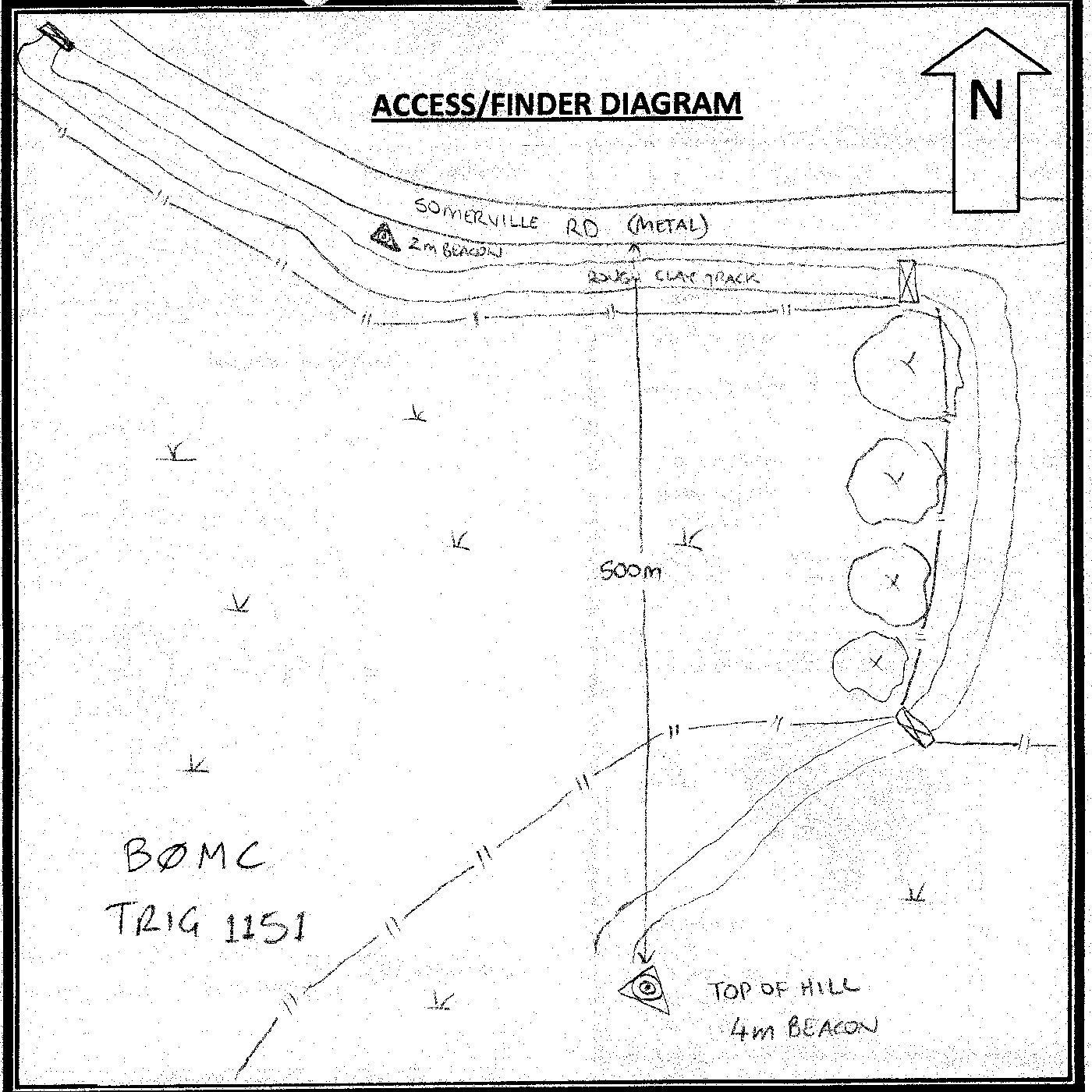
Access Notes:
Access from Sommerville Rd through deer gate 800m NW of trig 1151 which has a clarke beacon on it next to the road. Turn left and follow track SE following the road fence for 1.2km to pine shelter belt. Follow track right for 400m straight to trig. 4WD, 10mins
|
|
Access Date:
|
|
Cellphone coverage:
None to poor coverage
|
|
|
Access Diagram:
May not be to scale
|
|
|
|
Date Beacon Erected:
01-Jan-1978
|
|
Beacon Type:
* Four metre beacon
|
|
Beacon Measurement date:
* 08-Sep-2010
|
|
Beacon Eccentricity:
Central
|
|
|
Beacon Diagram:
|

|
|
*
The data in Landonline may be more recent