B0MC: Mark diagram 10-Nov-2007
(Superceded)
|
Mark and site detail
(Superceded)
|
Geodetic Code:
B0MC
|
|
Name:
1151 SO 58553
|
Mark type:
Pin
|
|
Land District:
North Auckland
|
Plan References:
|
|
Topo50 Reference:
AV29 848 082
|
NZTM:
6108156
1684777
|
|
|
Date established:
|
Date of Inspection:
* 10-Nov-2007
|
|
Mark Description:
* 10 mm s/s pin in 0.05 m dia galvanized iron pipe 0.16 m above ground level. Bottle as buried mark. Bronze ID plaque.
|
|
Mark Protection Structure Type:
* 3m or 4m Beacon.
Aluminium ID plate
|
|
GNSS Suitability:
|
|
Public ownership:
Unknown
|
|
|
|
|
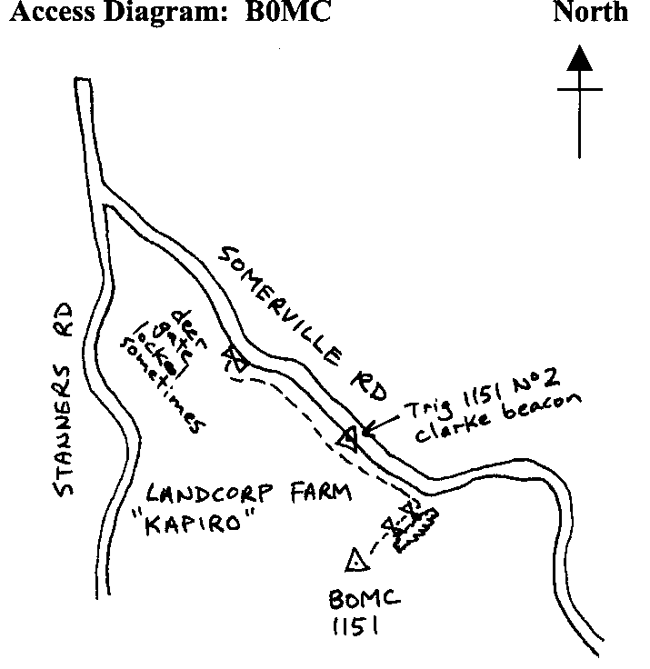
Access Restrictions:
Locked gate sometimes
|
|
Access Notes:
On top of hill 27 m south of fence and 38 m east of deer gate. Access from Sommerville Rd thru deer gate 800 m north/west of trig 1151 which has a Clarke beacon on it next to the road. Turn left and follow track south/east following the road fence for 1.2 km to pine shelter belt. Follow track right for 400 m straight to trig. 4WD, 10 mins
|
|
Access Date:
|
|
Cellphone coverage:
Telecom 027
|
|
|
Access Diagram:
May not be to scale
|
|
|
|
Date Beacon Erected:
01-Jan-1978
|
|
Beacon Type:
* Four metre beacon
|
|
Beacon Measurement date:
* 10-Nov-2007
|
|
Beacon Eccentricity:
Central
|
|
|
Beacon Diagram:
|

|
|
*
The data in Landonline may be more recent