AHQ5: Mark diagram 18-Apr-2018
|
Mark and site detail
|
Geodetic Code:
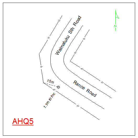
AHQ5
|
|
Name:
TAUNAMAU
|
Mark type:
Pin
|
|
Land District:
Southland
|
Plan References:
SO 11325
|
|
Topo50 Reference:
CG09 261 566
|
NZTM:
4856586
1226135
|
|
|
Date established:
21-Feb-1985
|
Date of Inspection:
18-Apr-2018
|
|
Mark Description:
* SS pin in 50mm galvanised iron pipe set in concrete. ID plaque. Bronze ID plaque.
|
|
Mark Protection Structure Type:
* Plastic Marker Post.
|
|
GNSS Suitability:
|
|
Public ownership:
Unknown
|
|
|
|
|
Access Restrictions:
|
|
Access Notes:
Situated on high point S of formation at the juncture of Waimatuku South Road and Rance Road.
|
|
Access Date:
|
|
Cellphone coverage:
Spark: Good, Vodafone: Good, 2Degrees: Not Tested
|
|
|
Access Diagram:
May not be to scale
|
|
|
|
Date Beacon Erected:
|
|
Beacon Type:
Not Beaconed
|
|
Beacon Measurement date:
18-Apr-2018
|
|
Beacon Eccentricity:
|
|
|
Beacon Diagram:
|

|
|
*
The data in Landonline may be more recent