AGMH: Mark diagram 16-Dec-2020
|
Mark and site detail
|
Geodetic Code:
AGMH
|
|
Name:
New Plymouth Fundamental
|
Mark type:
Pin
|
|
Land District:
Taranaki
|
Plan References:
SO 12436
|
|
Topo50 Reference:
BH29 892 763
|
NZTM:
5676348
1689161
|
|
|
Date established:
01-Jul-1970
|
Date of Inspection:
* 16-Dec-2020
|
|
Mark Description:
* SS pin in concrete block under cast iron cover.
|
|
Mark Protection Structure Type:
* Cast Iron Cover.
|
|
GNSS Suitability:
|
|
Public ownership:
Unknown
|
|
|
|
|
Access Restrictions:
Port Taranaki Access required. Pre-arrange access guardhouse at port gate.
|
|
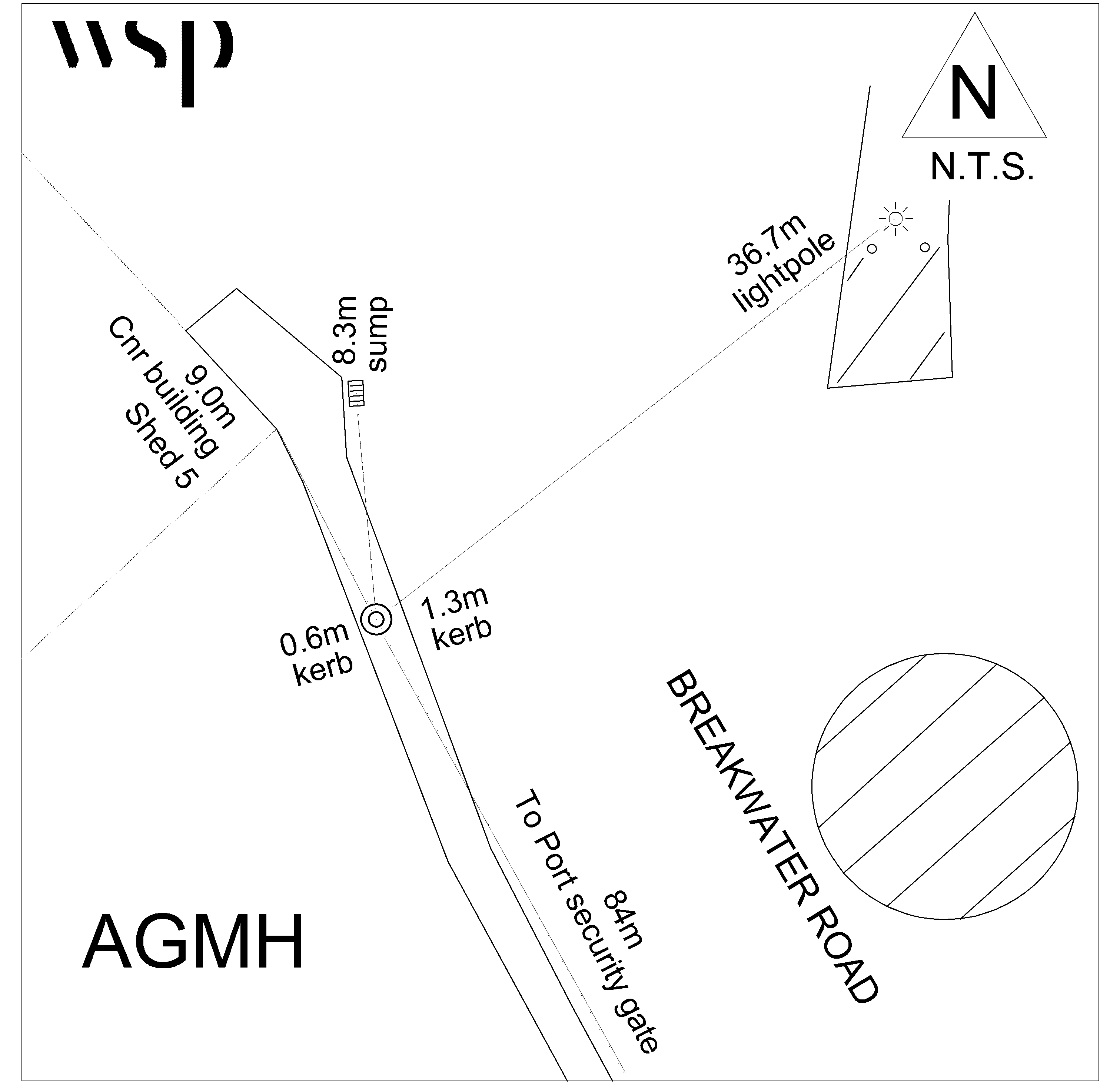
Access Notes:
Mark is in footpath on vehicle crossing outside C3 Truck inspection facility. Mark is approximately 84m from the Port Security Gate.
|
|
Access Date:
|
|
Cellphone coverage:
Spark: Good. Vodafone: Not Tested. 2Degrees: Not Tested
|
|
|
Access Diagram:
May not be to scale
|
|
|
|
Date Beacon Erected:
|
|
Beacon Type:
Not Beaconed
|
|
Beacon Measurement date:
* 16-Dec-2020
|
|
Beacon Eccentricity:
|
|
|
Beacon Diagram:
|

|
|
*
The data in Landonline may be more recent