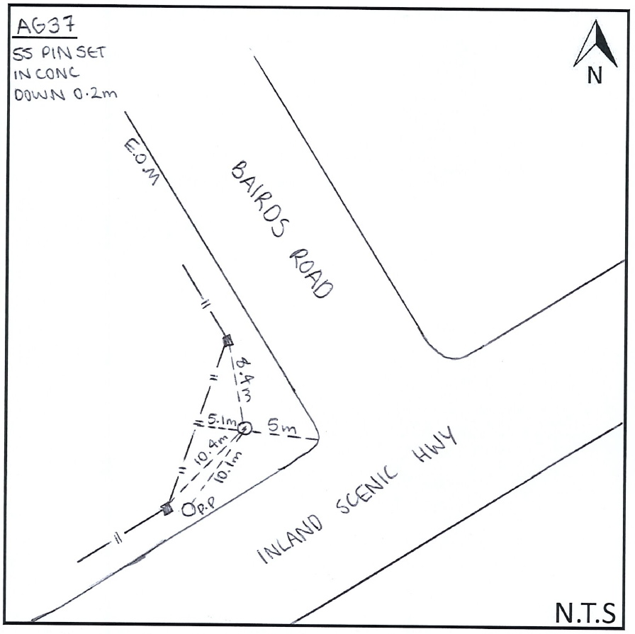
AG37: Mark diagram 04-Dec-2019
|
Mark and site detail
|
Geodetic Code:
AG37
|
|
Name:
UF 23
|
Mark type:
Pin
|
|
Land District:
Canterbury
|
Plan References:
SO 16013
|
|
Topo50 Reference:
BW24 712 105
|
NZTM:
5210527
1571212
|
|
|
Date established:
|
Date of Inspection:
04-Dec-2019
|
|
Mark Description:
* SS PIN SET IN CONCRETE BLOCK WITH METAL PLATE COVER.
|
|
Mark Protection Structure Type:
* Cast Iron Cover.
No protection.
|
|
GNSS Suitability:
|
|
Public ownership:
Unknown
|
|
|
|
|
Access Restrictions:
No access restrictions
|
|
Access Notes:
Located on the eastern side of the intersection of Upper Sefton and Bairds Rds in grass berm
|
|
Access Date:
|
|
Cellphone coverage:
Telecom: Good Vodafone: Good 2Degrees: Not tested
|
|
|
Access Diagram:
May not be to scale
|
|
|
|
Date Beacon Erected:
|
|
Beacon Type:
Not Beaconed
|
|
Beacon Measurement date:
04-Dec-2019
|
|
Beacon Eccentricity:
|
|
|
Beacon Diagram:
|

|
|
*
The data in Landonline may be more recent