ABJR: Mark diagram 03-Apr-2018
|
Mark and site detail
|
Geodetic Code:
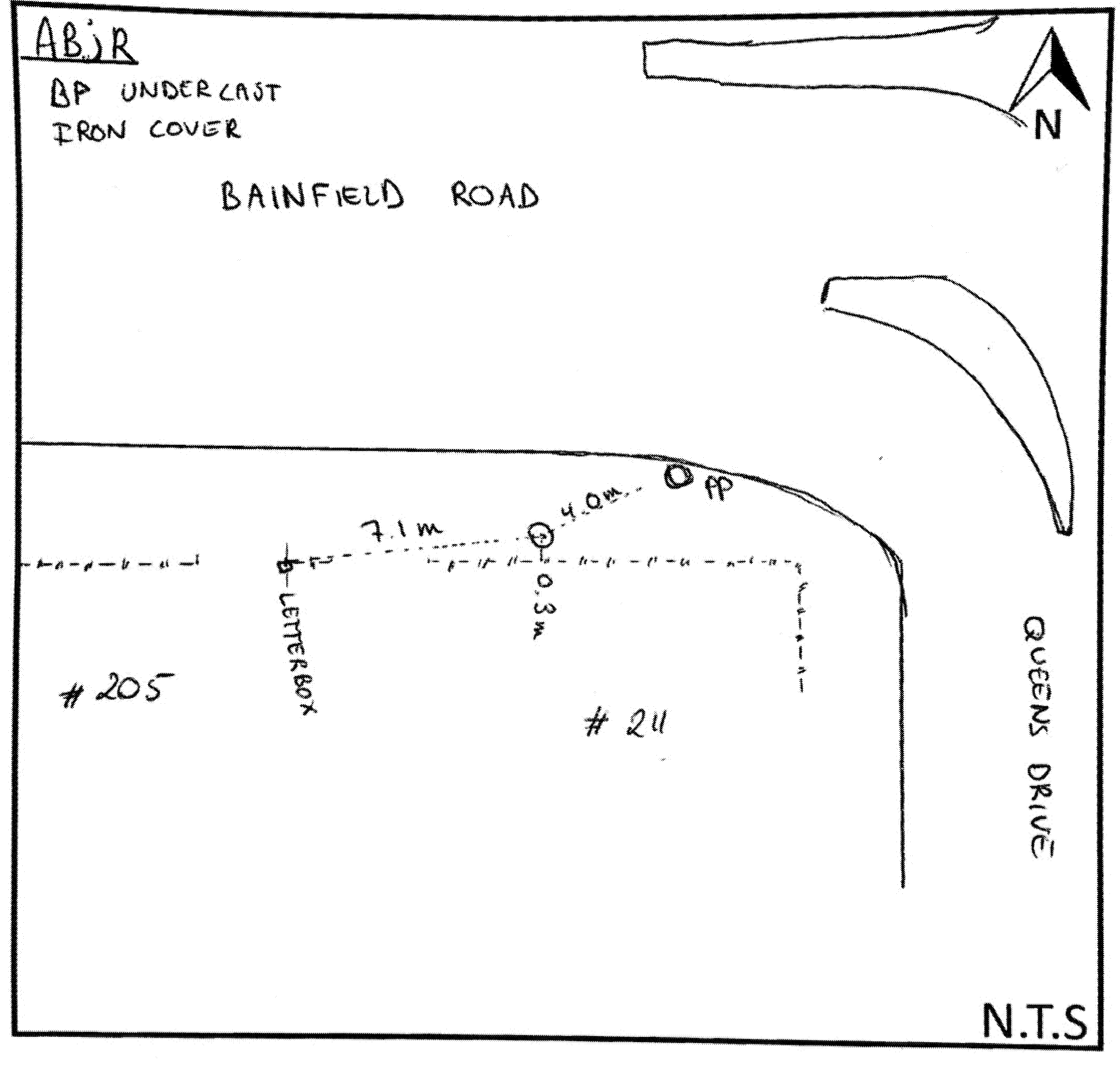
ABJR
|
|
Name:
ZA 4
|
Mark type:
Pin
|
|
Land District:
Southland
|
Plan References:
DP 490473
|
|
Topo50 Reference:
CG10 433 537
|
NZTM:
4853743
1243252
|
|
|
Date established:
01-Jan-1969
|
Date of Inspection:
03-Apr-2018
|
|
Mark Description:
* SS pin set in concrete under cast iron cover Bronze ID plaque.
|
|
Mark Protection Structure Type:
* Cast Iron Cover.
No protection.
|
|
GNSS Suitability:
|
|
Public ownership:
Unknown
|
|
|
|
|
Access Restrictions:
No access restrictions
|
|
Access Notes:
Located Southern side of Bainfield road outside #211. 50m West of intersection with Queens drive.
|
|
Access Date:
|
|
Cellphone coverage:
Spark: GOOD, Vodafone: Good, 2Degrees: Good
|
|
|
Access Diagram:
May not be to scale
|
|
|
|
Date Beacon Erected:
|
|
Beacon Type:
Not Beaconed
|
|
Beacon Measurement date:
03-Apr-2018
|
|
Beacon Eccentricity:
|
|
|
Beacon Diagram:
|

|
|
*
The data in Landonline may be more recent