ABHL: Mark diagram 07-Feb-2018
|
Mark and site detail
|
Geodetic Code:
ABHL
|
|
Name:
WELLSFORD FUNDAMENTAL
|
Mark type:
Pin
|
|
Land District:
North Auckland
|
Plan References:
SO 55096
|
|
Topo50 Reference:
AY31 365 833
|
NZTM:
5983277
1736528
|
|
|
Date established:
31-Mar-1976
|
Date of Inspection:
07-Feb-2018
|
|
Mark Description:
* Stainless steel pin set in concrete block below cast iron cover. Bronze ID plaque.
|
|
Mark Protection Structure Type:
* Cast Iron Cover.
Marker Post.
Aluminium ID plate
|
|
GNSS Suitability:
|
|
Public ownership:
Unknown
|
|
|
|
|
Access Restrictions:
|
|
Access Notes:
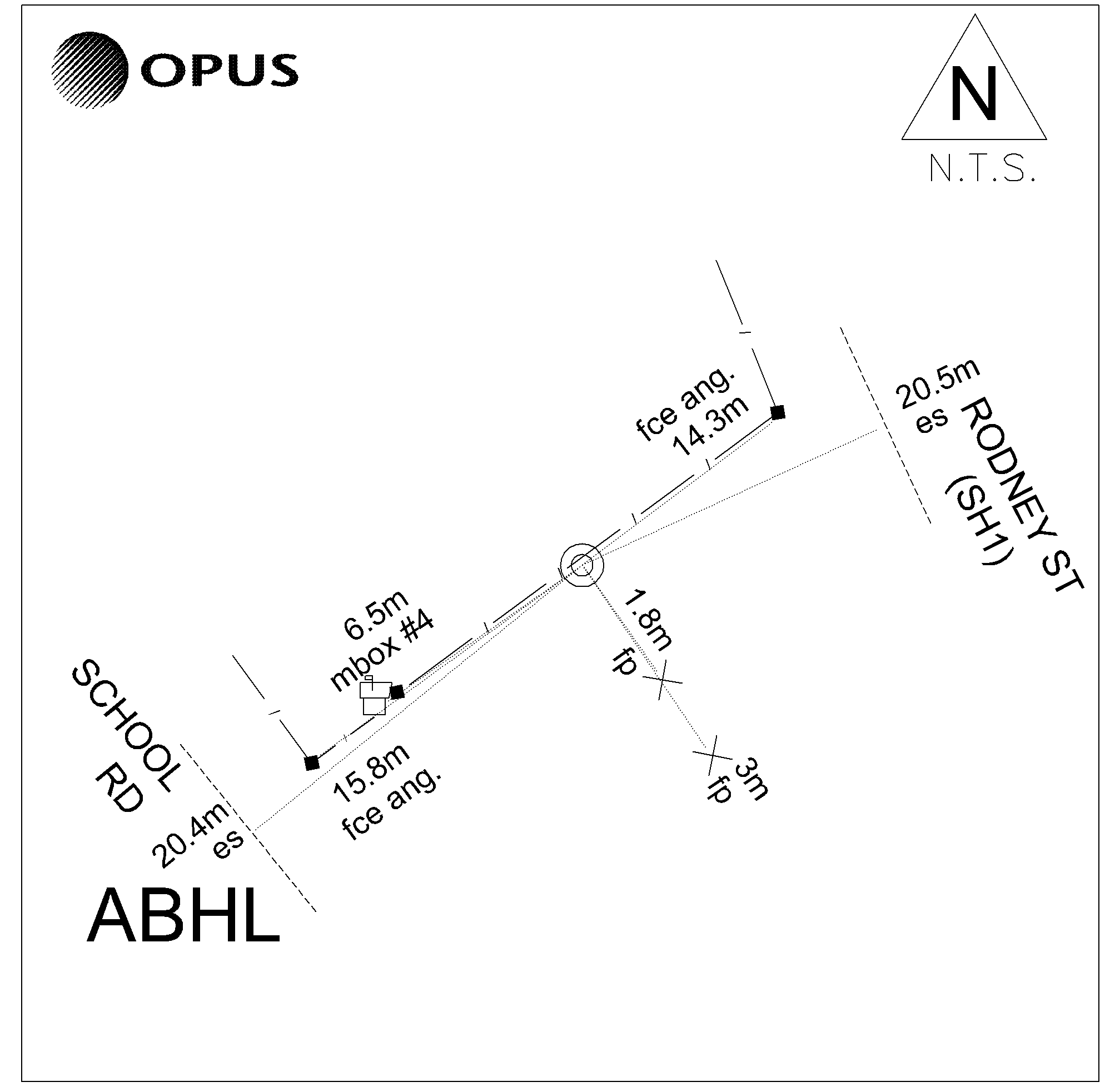
Mark is at the north end of the Wellsford Township at the intersection with School Road and S.H.1 on the northwest side near white picket fence. Mark is outside Vet building.
|
|
Access Date:
|
|
Cellphone coverage:
Spark: Good. Vodafone: Not Tested. 2Degrees: Not Tested
|
|
|
Access Diagram:
May not be to scale
|
|
|
|
Date Beacon Erected:
|
|
Beacon Type:
Not Beaconed
|
|
Beacon Measurement date:
07-Feb-2018
|
|
Beacon Eccentricity:
|
|
|
Beacon Diagram:
|

|
|
*
The data in Landonline may be more recent