ABHL: Mark diagram 10-Sep-2010
(Superceded)
|
Mark and site detail
(Superceded)
|
Geodetic Code:
ABHL
|
|
Name:
WELLSFORD FUNDAMENTAL
|
Mark type:
Pin
|
|
Land District:
North Auckland
|
Plan References:
SO 55096
|
|
Topo50 Reference:
AY31 365 833
|
NZTM:
5983277
1736528
|
|
|
Date established:
31-Mar-1976
|
Date of Inspection:
* 10-Sep-2010
|
|
Mark Description:
* Stainless steel pin set in concrete block below cast iron cover. Bronze ID plaque.
|
|
Mark Protection Structure Type:
* Cast Iron Cover.
Marker Post.
Aluminium ID plate
|
|
GNSS Suitability:
|
|
Public ownership:
Unknown
|
|
|
|
|
Access Restrictions:
|
|
Access Notes:
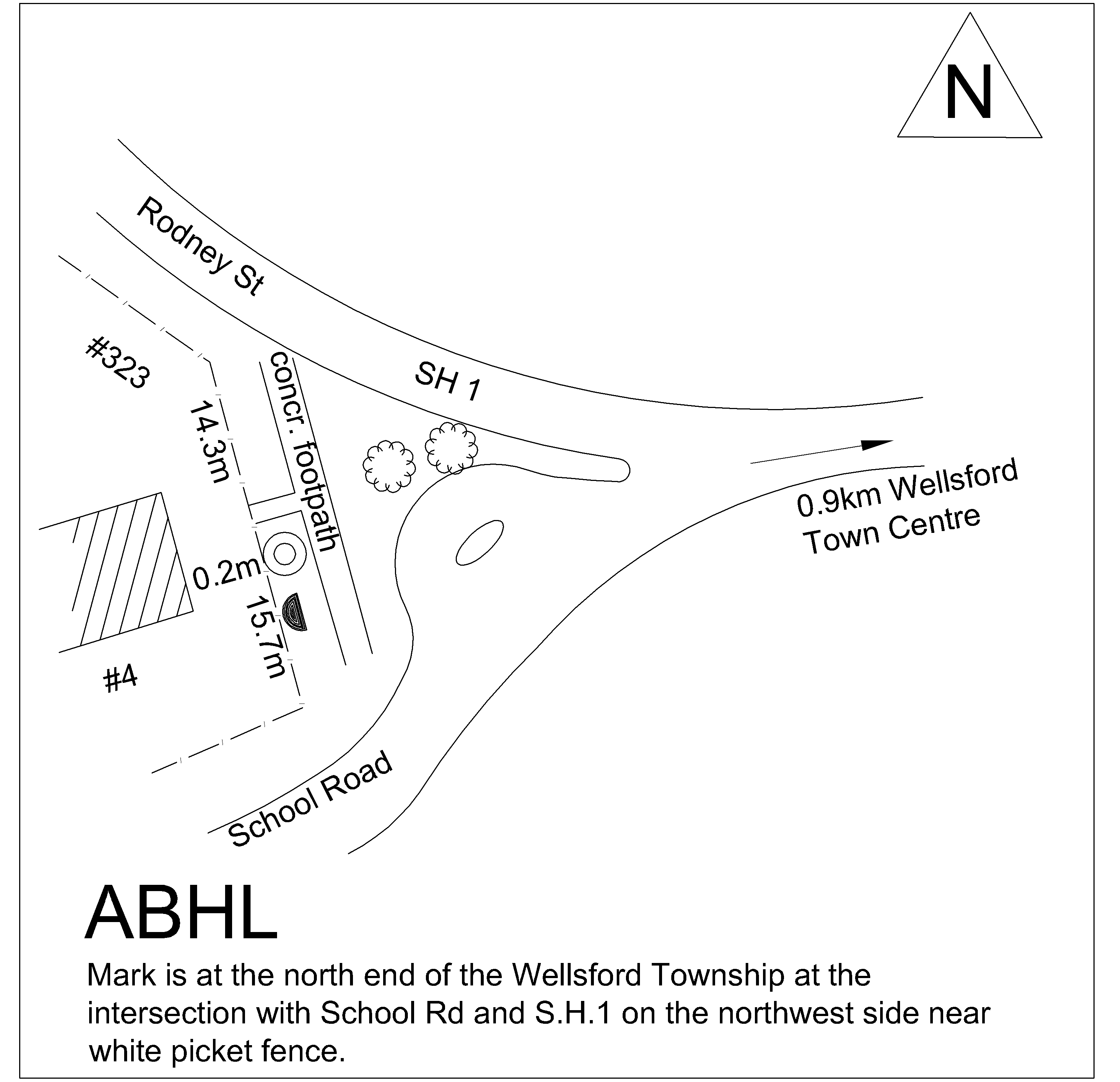
Mark is at the north end of the Wellsford Township at the intersection with School Rd and S.H.1 on the northwest side near white picket fence.
|
|
Access Date:
|
|
Cellphone coverage:
021 Vodafone ok
|
|
|
Access Diagram:
May not be to scale
|
|
|
|
Date Beacon Erected:
|
|
Beacon Type:
Not Beaconed
|
|
Beacon Measurement date:
* 10-Sep-2010
|
|
Beacon Eccentricity:
|
|
|
Beacon Diagram:
|

|
|
*
The data in Landonline may be more recent