A9VU: Mark diagram 14-Feb-2011
(Superceded)
|
Mark and site detail
(Superceded)
|
Geodetic Code:
A9VU
|
|
Name:
OMARU
|
Mark type:
Pin
|
|
Land District:
North Auckland
|
Plan References:
|
|
Topo50 Reference:
AY29 994 068
|
NZTM:
6006790
1699402
|
|
|
Date established:
31-Dec-1987
|
Date of Inspection:
* 14-Feb-2011
|
|
Mark Description:
* S/S Pin centre of tube set in conc. Bronze ID plaque.
|
|
Mark Protection Structure Type:
* 2m Beacon.
Aluminium ID plate
|
|
GNSS Suitability:
|
|
Public ownership:
Unknown
|
|
|
|
|
Access Restrictions:
|
|
Access Notes:
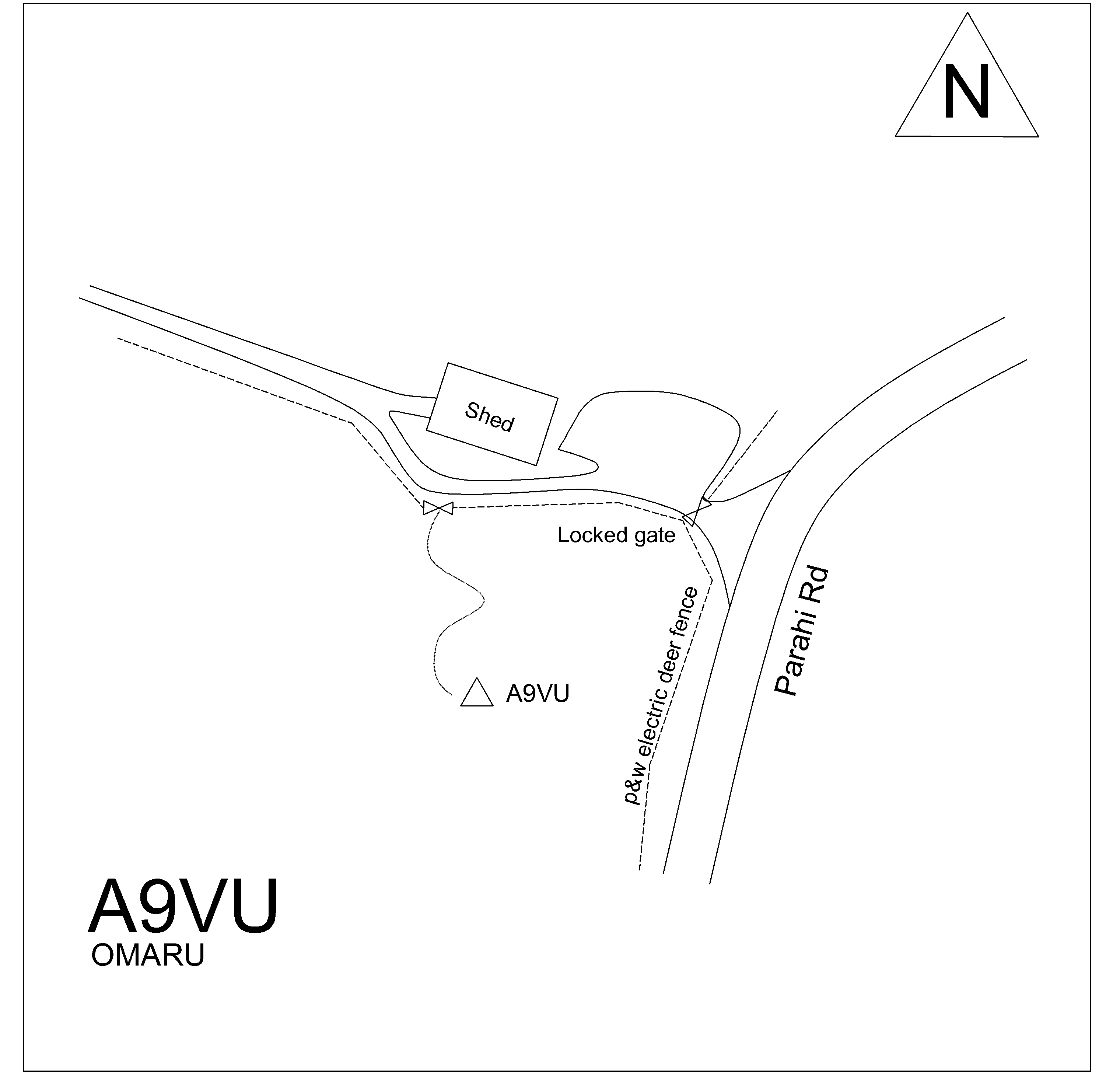
Mark is on top of hill on the West side of Parahi Road near the intersection of Oparakau Road.
|
|
Access Date:
|
|
Cellphone coverage:
Vodafone/Telecom Ok
|
|
|
Access Diagram:
May not be to scale
|
|
|
|
Date Beacon Erected:
31-Dec-1987
|
|
Beacon Type:
* Two metre beacon
|
|
Beacon Measurement date:
* 14-Feb-2011
|
|
Beacon Eccentricity:
Central
|
|
|
Beacon Diagram:
|

|
|
*
The data in Landonline may be more recent