A94Q: Mark diagram 29-Mar-2008
(Superceded)
|
Mark and site detail
(Superceded)
|
Geodetic Code:
A94Q
|
|
Name:
D POROA
|
Mark type:
Pin
|
|
Land District:
South Auckland
|
Plan References:
|
|
Topo50 Reference:
BE40 487 736
|
NZTM:
5773561
1948690
|
|
|
Date established:
01-Jan-1953
|
Date of Inspection:
* 29-Mar-2008
|
|
Mark Description:
* 13 mm stainless steel pin in 0.05m dia iron pipe with concrete collar 0.11 m above ground level. Inverted bottle as buried mark. Bronze ID plaque.
|
|
Mark Protection Structure Type:
* 2m Beacon.
Aluminium ID plate
|
|
GNSS Suitability:
|
|
Public ownership:
Unknown
|
|
|
|
|
Access Restrictions:
|
|
Access Notes:
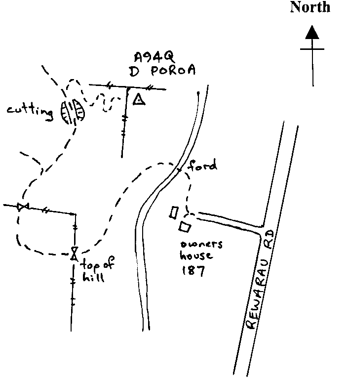
On top of hill in area overgrown with low creeper 5 m south of fence and 9 m east of fence corner. From land owner's house follow metalled track fording stream then south up hill behind house. Through gate then follow 4x4 grass track which goes west of station. Turn east for 400 m up poor track along spur to within 40 metres of station. ATV best for last section.
|
|
Access Date:
|
|
Cellphone coverage:
027 Telecom
|
|
|
Access Diagram:
May not be to scale
|
|
|
|
Date Beacon Erected:
30-Aug-1986
|
|
Beacon Type:
* Two metre beacon
|
|
Beacon Measurement date:
* 29-Mar-2008
|
|
Beacon Eccentricity:
Eccentric 0.02 m south, Now Central
|
|
|
Beacon Diagram:
|

|
|
*
The data in Landonline may be more recent