A94Q: Mark diagram 19-Feb-2014
(Superceded)
|
Mark and site detail
(Superceded)
|
Geodetic Code:
A94Q
|
|
Name:
D POROA
|
Mark type:
Pin
|
|
Land District:
South Auckland
|
Plan References:
SO 44832
|
|
Topo50 Reference:
BE40 487 736
|
NZTM:
5773561
1948690
|
|
|
Date established:
01-Jan-1953
|
Date of Inspection:
* 19-Feb-2014
|
|
Mark Description:
* 13mm stainless steel pin in 0.05m dia. iron pipe with concrete collar 0.11m above ground level. Inverted bottle as buried mark. Bronze ID plaque.
|
|
Mark Protection Structure Type:
* 2m Beacon.
Aluminium ID plate
|
|
GNSS Suitability:
|
|
Public ownership:
Unknown
|
|
|
|
|
Access Restrictions:
Contact owner before entering property.
|
|
Access Notes:
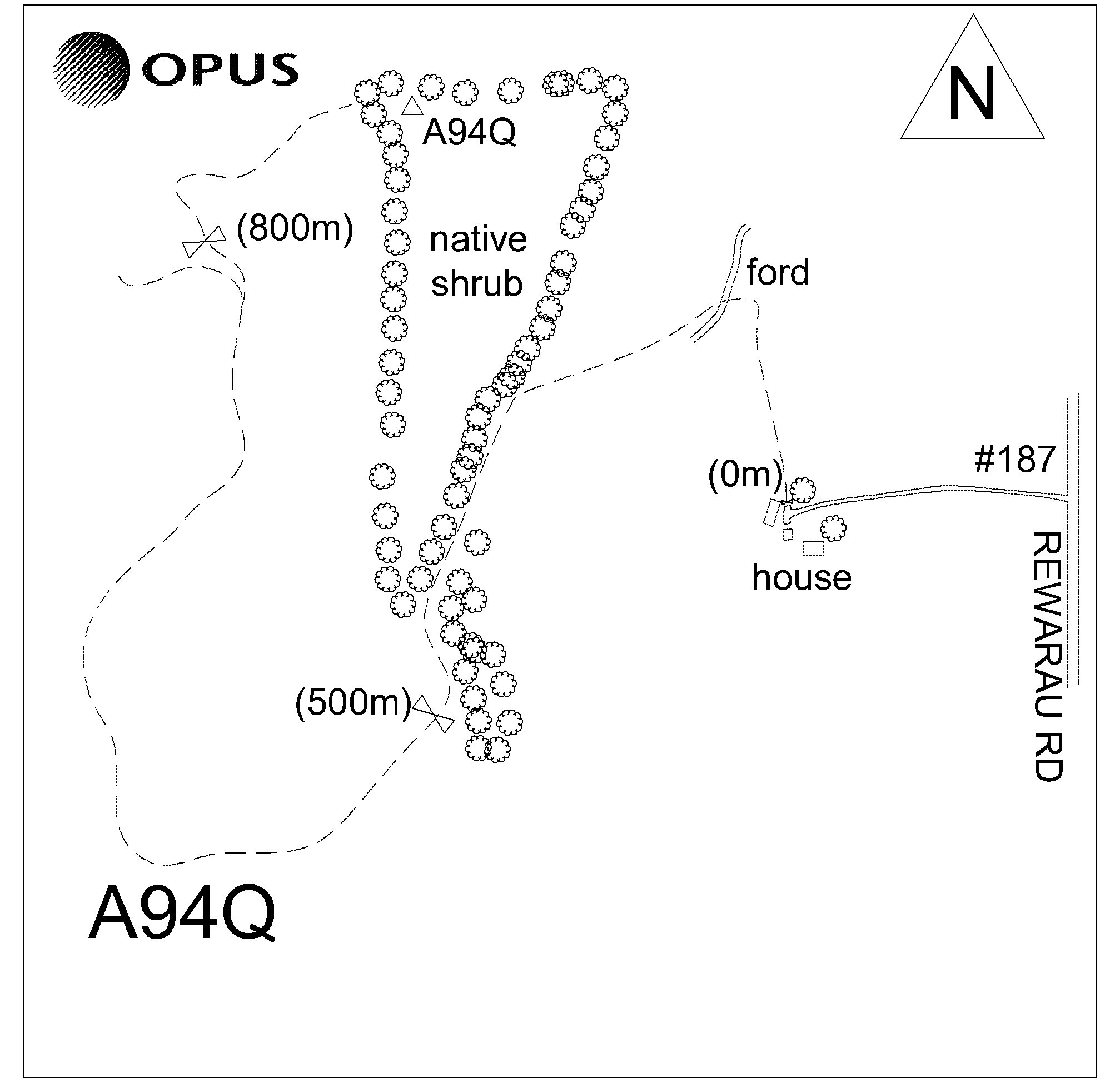
On top of hill in area overgrown with low creeper 5m south of fence and 9m east of fence corner. From 187 Rewarau Rd head towards house and enter gate on right near sheds and follow metalled track through fording stream then south up hill behind house (500m). Enter through gate then follow 4x4 grass track for approx. 800m to gate on right. Enter paddock and head up hill following grass track past water tank to top of hill along ridge to fence line. 4wd right to trig in dry conditions.
|
|
Access Date:
|
|
Cellphone coverage:
Telecom: Not Tested. Vodafone: Good. 2Degrees: Not Tested
|
|
|
Access Diagram:
May not be to scale
|
|
|
|
Date Beacon Erected:
30-Aug-1986
|
|
Beacon Type:
* Two metre beacon
|
|
Beacon Measurement date:
* 19-Feb-2014
|
|
Beacon Eccentricity:
Central
|
|
|
Beacon Diagram:
|

|
|
*
The data in Landonline may be more recent