A94M: Mark diagram 21-Feb-2005
|
Mark and site detail
|
Geodetic Code:
A94M
|
|
Name:
7821
|
Mark type:
* Pin
|
|
Land District:
Gisborne
|
Plan References:
|
|
Topo50 Reference:
BE41 721 778
|
NZTM:
5777775
1972129
|
|
|
Date established:
01-Jan-1971
|
Date of Inspection:
* 21-Feb-2005
|
|
Mark Description:
* 10 mm stainless steel pin in 0.05 m dia galvanized iron pipe. 0.20 m above ground level. No known buried mark. Bronze ID plaque.
|
|
Mark Protection Structure Type:
* 2m Beacon.
Aluminium ID plate
|
|
GNSS Suitability:
|
|
Public ownership:
Unknown
|
|
|
|
|
Access Restrictions:
|
|
Access Notes:
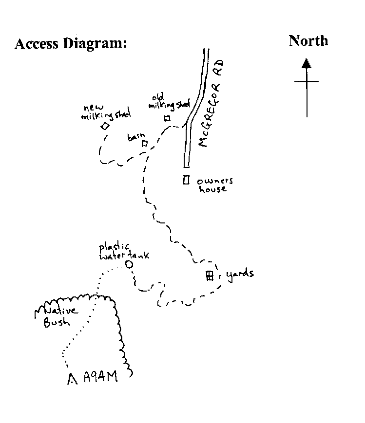
On top of hill along narrow ridge. Access from McGregor Rd, turn right before last house to old milking shed and continue to red barn, and turn left. Follow 4WD track to old cattle yard and pass on left and follow rough 4WD track up hill to black plastic water tank. Walk up spur to edge of bush and follow rough track up ridge thru bush to trig. 40 mins walk.
|
|
Access Date:
|
|
Cellphone coverage:
|
|
|
Access Diagram:
May not be to scale
|
|
|
|
Date Beacon Erected:
30-Jan-1975
|
|
Beacon Type:
Two metre beacon
|
|
Beacon Measurement date:
* 21-Feb-2005
|
|
Beacon Eccentricity:
|
|
|
Beacon Diagram:
|

|
|
*
The data in Landonline may be more recent