A7A3: Mark diagram 17-Mar-2009
|
Mark and site detail
|
Geodetic Code:
A7A3
|
|
Name:
37 PUKEWHARARIKI
|
Mark type:
Pin
|
|
Land District:
North Auckland
|
Plan References:
|
|
Topo50 Reference:
AX28 730 337
|
NZTM:
6033728
1672973
|
|
|
Date established:
|
Date of Inspection:
17-Mar-2009
|
|
Mark Description:
* 25mm dia. SS pin in 75mm tube branded ''37'' in concrete. Trig previously known as Pukewharaiki, refer CON 346 UW1 01 of 20/11/98 (email). 4m wooden beacon not modified for GPS Bronze ID plaque.
|
|
Mark Protection Structure Type:
* 3m or 4m Beacon.
Aluminium ID plate
|
|
GNSS Suitability:
|
|
Public ownership:
Unknown
|
|
|
|
|
Access Restrictions:
Locked gate.
|
|
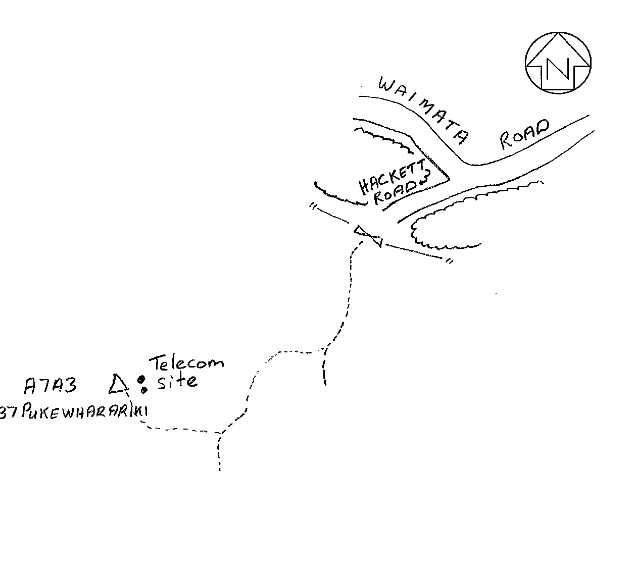
Access Notes:
From end of Hackett Road follow access track SW to trig at top of hill beside Telecom mast. 4WDs only on Telecom track (OSH). Colin's cell phone No. is 027 341 8487
|
|
Access Date:
|
|
Cellphone coverage:
Available (027 Telecom)
|
|
|
Access Diagram:
May not be to scale
|
|
|
|
Date Beacon Erected:
|
|
Beacon Type:
Four metre beacon
|
|
Beacon Measurement date:
17-Mar-2009
|
|
Beacon Eccentricity:
Central
|
|
|
Beacon Diagram:
|

|
|
*
The data in Landonline may be more recent