A2BM: Mark diagram 14-Jun-2005
(Superceded)
|
Mark and site detail
(Superceded)
|
Geodetic Code:
A2BM
|
|
Name:
3 MATAKA
|
Mark type:
Pin
|
|
Land District:
North Auckland
|
Plan References:
|
|
Topo50 Reference:
AV29 016 085
|
NZTM:
6108535
1701558
|
|
|
Date established:
|
Date of Inspection:
* 14-Jun-2005
|
|
Mark Description:
* 10 mm stainless steel pin in 0.05 m dia iron pipe. No known buried mark. Bronze ID plaque.
|
|
Mark Protection Structure Type:
* 3m or 4m Beacon.
Aluminium ID plate
|
|
GNSS Suitability:
|
|
Public ownership:
Unknown
|
|
|
|
|
Access Restrictions:
Locked gate
|
|
Access Notes:
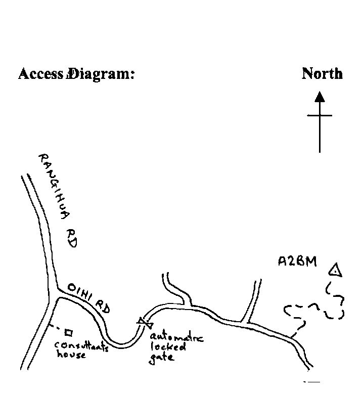
On top of hill 70 m east of wooden pole aerial. Access from Purerua Rd into Rangihua Rd and into Oihi Rd (which leads to Marsden Cross), and follow 1.3 km to locked automatic gate. Enter combination code, and follow good metalled road for 2.1 km and turn left up 4WD metalled track before sea can be seen. Follow track to top of hill and trig.
|
|
Access Date:
|
|
Cellphone coverage:
|
|
|
Access Diagram:
May not be to scale
|
|
|
|
Date Beacon Erected:
30-Apr-1988
|
|
Beacon Type:
* Four metre beacon
|
|
Beacon Measurement date:
* 14-Jun-2005
|
|
Beacon Eccentricity:
|
|
|
Beacon Diagram:
|

|
|
*
The data in Landonline may be more recent