1242: Mark diagram 18-Jan-2017
|
Mark and site detail
|
Geodetic Code:
1242
|
|
Name:
BLUFF NO 2
|
Mark type:
Pin
|
|
Land District:
Taranaki
|
Plan References:
SO 12776
|
|
Topo50 Reference:
BK30 305 122
|
NZTM:
5612227
1730488
|
|
|
Date established:
01-Jan-1930
|
Date of Inspection:
18-Jan-2017
|
|
Mark Description:
* This mark is used for deformation monitoring do not alter the ground mark in any way. 12 mm stainless steel pin in 0.05 m dia galvanized iron pipe. No known buried mark. Bronze ID plaque.
|
|
Mark Protection Structure Type:
* 2m Beacon.
Aluminium ID plate
|
|
GNSS Suitability:
|
|
Public ownership:
Unknown
|
|
|
|
|
Access Restrictions:
No access restrictions
|
|
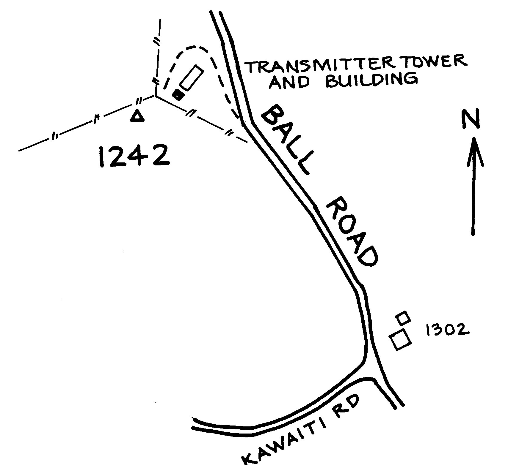
Access Notes:
On flat hill 5 m south of fence and 19 m west of fence corner. Access from Ball Rd. Thru gate and up 2WD sealed track to microwave tower and building. Walk 30 metres.
|
|
Access Date:
|
|
Cellphone coverage:
Spark: Good. Vodafone: Good. 2Degrees: Good
|
|
|
Access Diagram:
May not be to scale
|
|
|
|
Date Beacon Erected:
25-Jan-2012
|
|
Beacon Type:
Two metre metal beacon
|
|
Beacon Measurement date:
18-Jan-2017
|
|
Beacon Eccentricity:
CENTRAL
|
|
|
Beacon Diagram:
|

|
|
*
The data in Landonline may be more recent